
How do I embed a YouTube video into my article, comment or post?
This is easy using Backcountry BC's Videobox Plugin. The following is a typical Youtube URL (Monster in the Woods): https://www.youtube.com/watch?v=v336YH-atBU
Use the following tags with the YouTube Video ID as follows (Asterix added at the start to so as to not trigger the module):
{*videobox}v336YH-atBU{/videobox}
To add a description below your video add the following after the video idea: |Description
Example:
{*videobox}v336YH-atBU|Description of The Video Goes Here{/videobox}
This results in the following in your article:
 Description of The Video Goes Here
How do I add a photo gallery into my article, comment or post?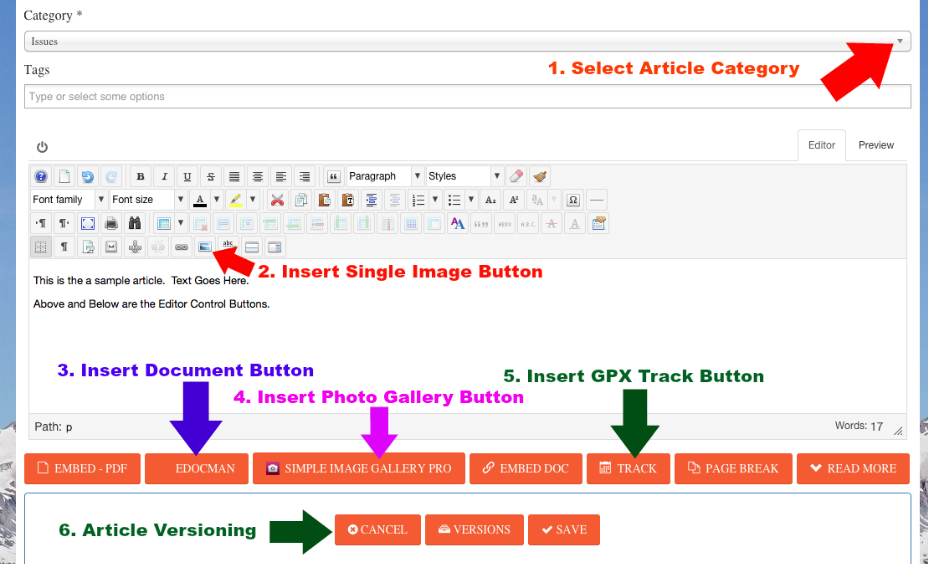
First, Click in the body of your aricle in the text editor to place the cursor where you want to insert your photo gallery. At the bottom of the Text Editor is a button labeled "Simple Image Gallery Pro" with a red camera icon to the left of it. Click on the button, then follow the instructions provided by of the component. It is easy to create photo galleries and insert them into your articles with this button in the Text Editor. The component also allows for multiple file uploads.
How do I display a map with a GPX track in my article, comment or post?
This is easy because our trail database component is fully integrated with all other areas and components on Backcountry BC.
Step 1: Click in the body of your article in the text editor to place the cursor where you want to insert your track
Step 2: Click on the "Track" button at the bottom of the text editor (see Screenshot Above)
Step 3: Select the track in from the list of tracks.
Note that you will have to add the track to the trail database first if it does not already exist.
IMPORTANT: Only one GPX map can be displayed in a single article using this plugin.
Example of the Watersprite Trail inserted into this article:
- Min Elevation
- 811 m
- Total Distance
- 8.49 km
- Max Elevation
- 1479 m
- Way Points
- 0
- Total Elevation Gain
- 1136 m
- Track Points
- 583
- Total Elevation Loss
- 468 m
| Values not available in the file may shown as 0. | |||
|
This track was downloaded 13 time(s). Please register/login to download this track. |