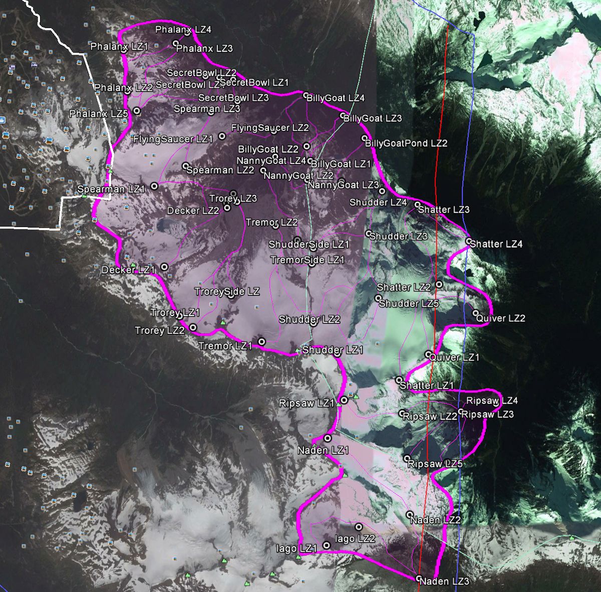
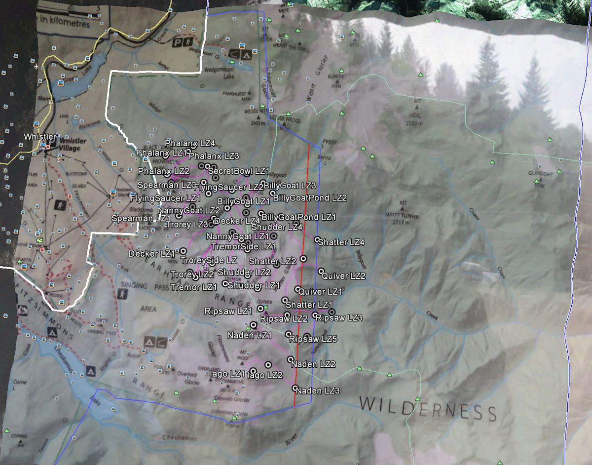
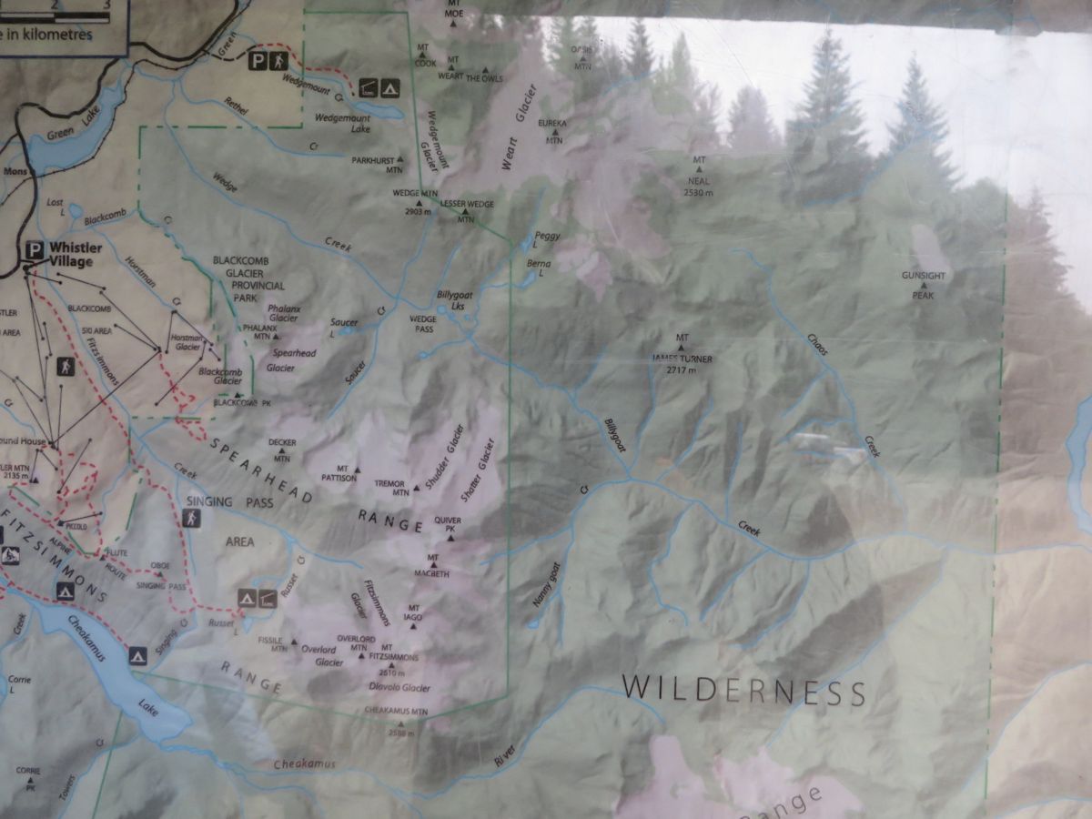
The following maps pertaining to the Garibaldi Park Wilderness Conservation Zone and the Whistler Heli-Ski Park Use Permit are constructed from BC Park's own map of the wilderness conservancy posted at the Elfin Lakes Trailhead. The BC Parks map of the Wilderness Conservation Zone suggests that the conflict between Heli-Ski Operations in Garibaldi Park and the Wilderness Conservation Zone is much worse than previously mapped and understood by Garibaldi Park 2020.
The blue line represents the wilderness conservation zone as previously mapped by Garibaldi Park 2020.
The Red line represents the wilderness conservation zone as represented by the BC Parks Map. Note that this adds an additional two helicopter landings zones into the Wilderness Conservation Zone of Garibaldi Park.
The Purple Shaded Area is the Whistler Heli-Ski Tenure.
Map Files:
Wilderness Conservancy Zone Map
Spearhead PUP Overlay1 Map
Spearhead PUP Overlay2 Map

The Heli-Ski Tenure Overlaid onto BC Park's own map:

The Original, BC Parks Map as photographed at the Elfin Lakes Trailhead.

