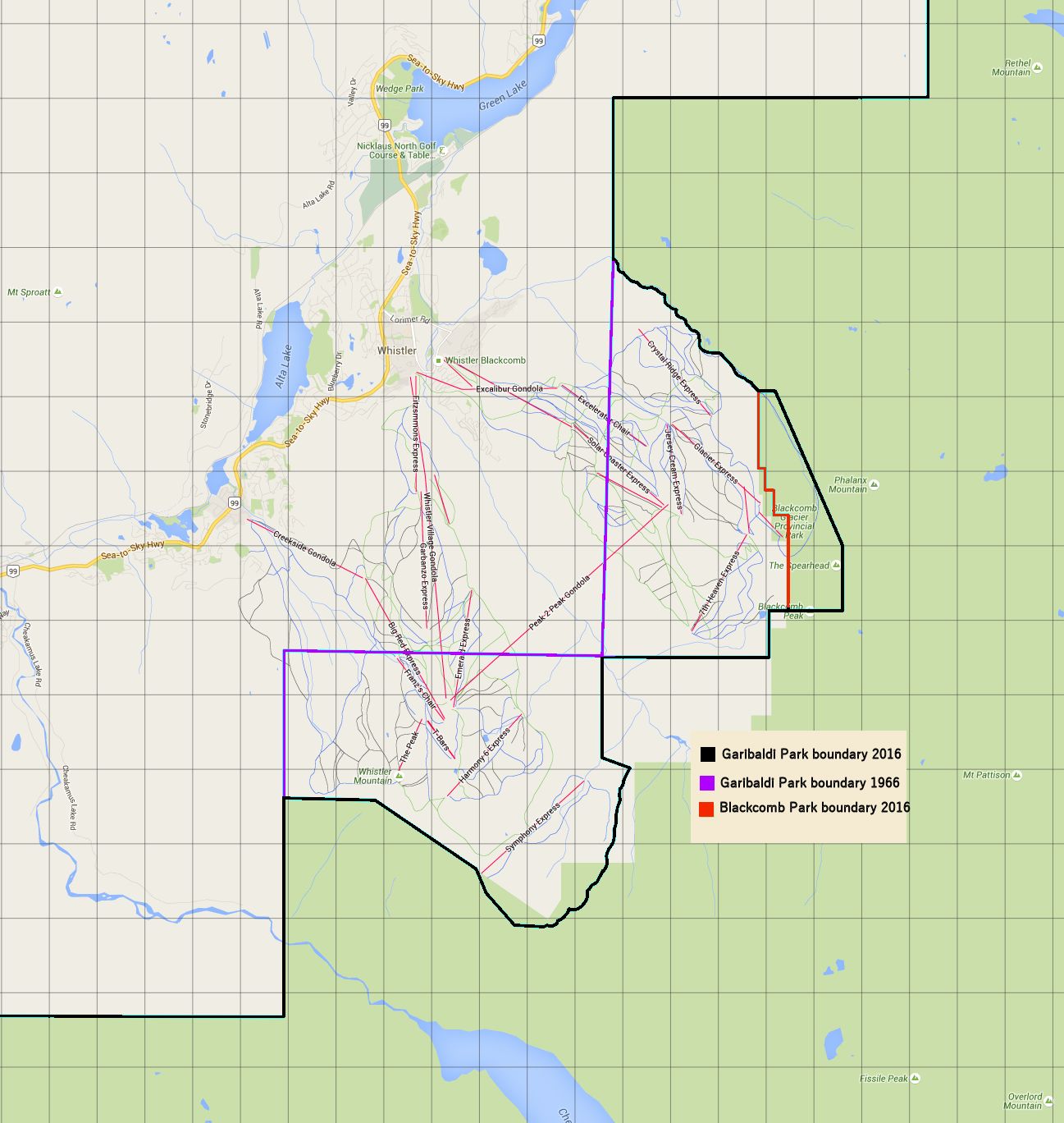
These are the combined deletions from the Garibaldi Provincial Park boundary extant in 1966 that were transferred to Whistler and Blackcomb ski areas or to Blackcomb Glacier Provincial Park.
Click Here for Gmap Rendering
- Min Elevation
- 0 m
- Total Distance
- 33.72 km
- Max Elevation
- 0 m
- Total Time
- 0h 00m 00s
- Total Elevation Gain
- 0 m
- Way Points
- 0
- Total Elevation Loss
- 0 m
- Track Points
- 452
- Max Speed
- 0 m/s
- Route Points
- 0
- Average Speed
- 0 m/s
|
This track was downloaded 0 time(s). Please register/login to download this track. |
Since Whistler Mountain opened for skiing in 1966 there have been 6 or 7 transfers of land from Garibaldi Park to Whistler and Blackcomb. The total transfer areas are about 1450 Ha to Whistler and 1650 Ha to Blackcomb. That is an astonishing 32.8 square kilometers combined according to our researchers and calculations.
The majority of Whistler Blackcomb’s skiing takes place on land that was part of Garibaldi Park before 1966. Without the transfers Blackcomb would be limited to the Excelerator and Wizard chairs, low on the mountain. Whistler would not have the Peak, Harmony, Symphony, Big Red or Emerald chairs or the Roundhouse.
The sources for this information are:
- Map of South Western British Columbia, scale 10 miles to 1 inch. Published by Department of Lands, Forests and Water Resources, British Columbia. Edition: January 4, 1955 with corrections to January 1963.
- Rupert Merer, private correspondence - Reference: https://backcountrybc.ca/index.php/97-media/maps/historical-maps/75-historical-maps
The map outline shows the 2016 Garibaldi Provincial Park boundary, Blackcomb Glacier Provicial Park boundary and the 1966 Garibaldi Provincial Park boundary.
Alternative Map/Presentation: