- You are here:
-
Home

-
Maps and Media
-
Custom Maps
-
Spearhead Heli-skiing Custom Map
-
Issues
-
Mainland / Southwest
-
Sea to Sky
- Callaghan Lake Region
Callaghan Lake Region
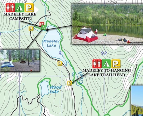
HikeInWhistler.com reports on its website: This year Whistler Sport Legacies and Whistler Photo Safaris have blocked public access to Madeley Lake. Whistler Photo Safaris now refers to Madeley Lake as "within our 2700 acre gated bear habitat." This new gate installed in the spring of 2020 was a surprise to those of us who love this amazing lake and hike the decades old, popular Madeley to Hanging Lake trail which connects to Rainbow Lake, which descends down the Rainbow Trail to Alta Lake Road in Whistler. Hopefully this gate will be gone soon as apparently everyone, including the Resort Municipality of Whistler were unaware of it until recently. Blocking public access to what was recently public land in order to allow a private company to profit off it as an expensive pay access safari park seems like a bad idea.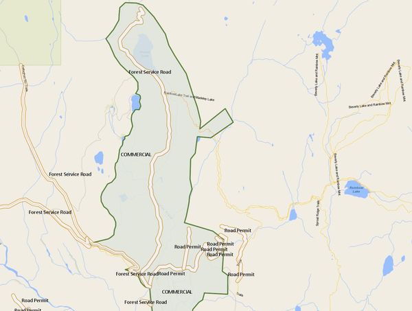
Original Backcountry BC User Question:
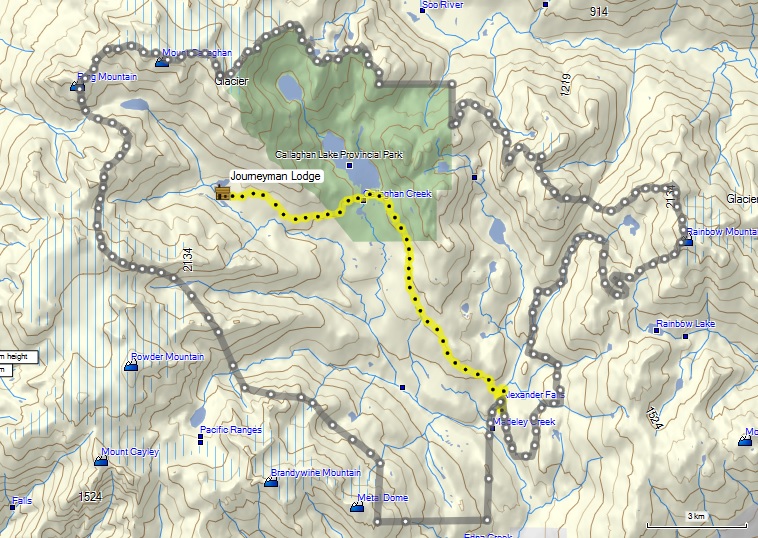
The intent behind a FOI request I made was to research a surprise I found while hiking near Hidden Peak on 20190728. I found a heli landing pad marker stake is on the flat patch at 50.21577, -123.23189. This appears to be just inside the Park boundary. Based on the FOI results, two heli operators are permitted to operate inside the Conservancy, but not the Park. It is likely that this stake belongs to one of these two companies. It is therefore possible that one (or both) of these companies may be operating outside the permitted scope of acceptable landing zones.
It may also be worth noting that I know of a landing zone which is occasionally used at 50.22454, -123.24249. I have heard of this landing zone referred to as "Borderline Landing". The "Borderline Landing" is on the border of the Callaghan Conservancy and unallocated Crown land; but is a modest 35m outside of the Park.
Callaghan heliski operator names/licence numbers
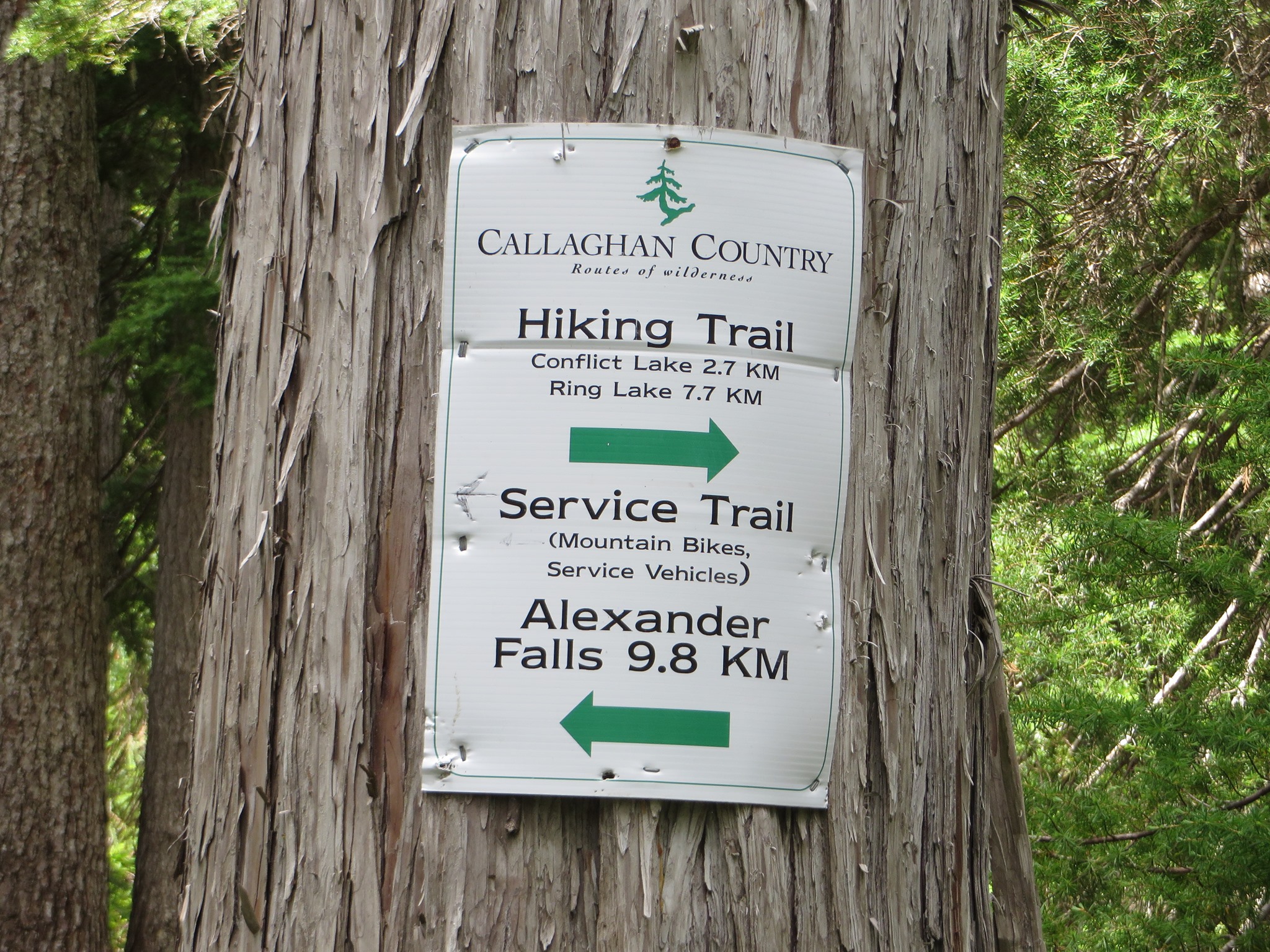
The ACC-Whistler provided the following update regarding the current understanding for backcountry access through Whistler Olympic Park.
If you are entering WOP during open hours the access fee is per vehicle not per person. If one of the people in the vehicle has a WOP/Ski Callaghan season’s pass there isn’t an entry fee.
The Alexander Falls parking is “really for” ski tourers returning through WOP after hours or for people going overnight. It was not designed for early access prior to WOP opening. However, unofficially people do use it for backcountry access before WOP opens. There isn’t a fee in that case.
During much of the ski season WOP is open until 9 PM on Wednesdays and some Friday nights. This is clearly the best time to go if those days work for you.
If you park in WOP you need the dashboard info sheet displayed in case of emergency. Even at Alexander Falls this would be useful if your vehicle is there after dark.
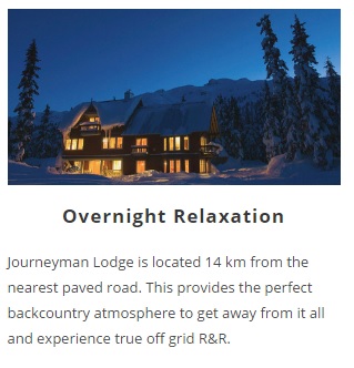
It should be noted that the Solitude Glacier area is not accessible by the “public” unless you buy a cross country pass from Callaghan Country (Brad Sills). It is primarily used by guides and guests doing trips from the Journeyman Lodge. The access from the Powdercap requires crossing of a motorized snowmobile accessible zone. There should be a BAC required on the side of the provincial Callaghan Lake road which is how this area has traditionally been accessed and still is once Callaghan Country is closed after April 18th. Guides and guests also have the option of having themselves or their gear being transported through the “non motorized zone” to the lodge by snowcat or snowmobile via the Callaghan Lake road. The non motorized and non commercial status of this area remains very questionable and the section 58 was designed specifically for Callaghan Country as you can see on the map below.
Clear here to download map below: Solitude Glacier Map