Log in
x
or
x
Register
x
or

bcmclogo

Chris's Mount Norman Adventure on South Pender Island
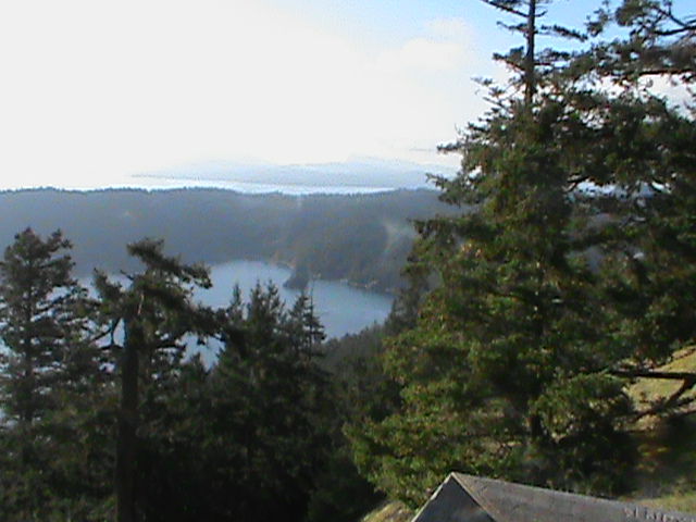
Trail Authorization Status: Unknown


Mt. Norman Summit

This hike in the Gulf Islands National Park Reserve consists of three separate trails.  I performed this as a solo hike in the summer of 2014 going West to East.  This trip first begins at the West Tip of South Pender Island which is called Ainslie Point and ends on the summit of Mount Norman.  The Trail from Ainslie Point to the summit of Mount Norman is known as the Ainslie Point Road Trail.  From the summit of Mount Norman, I descended the Canal Road Trail to the second trailhead at the North East side of the park.  I then continued onto the William Walker Trail which exits the park after one KM and continues on for another 1.3 KM until finally terminating at a small beach on the ocean.  I then hitch-hiked back to my car at the Ainslie Point Road Trailhead.

DSC01669 

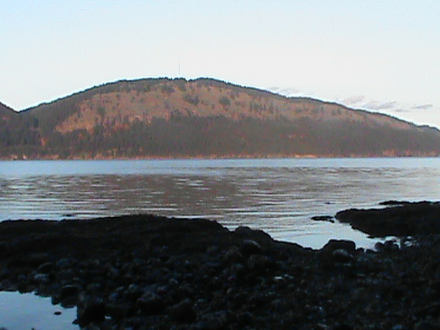
Saturna Island from the Ocean and end of the William Walker Trail

Category: Gulf Island Hikes 7 years ago
Chris Ludwig
Created 7 years ago

Like it on Facebook, Tweet it or share this track on other bookmarking websites.

Rate this track:

Not rated yet

Min Elevation
6 m
Total Distance
4.85 km
Max Elevation
237 m
Way Points
0
Total Elevation Gain
497 m
Track Points
200
Total Elevation Loss
563 m
Values not available in the file may shown as 0.

This track was downloaded 1 time(s).

Please register/login to download this track.
Please wait while loading suggestions..

Comments   

0 # Chris Ludwig 2017-11-01 22:23
This is the longest sustained hike to be found on the Pender Islands. Although Cramer Hill on North Pender Island is known as the "Grouse Grind" of Pender Island because of its steepness.

You have no rights to post comments

openstreetmap
400px
http://{s}.tile.openstreetmap.org/{z}/{x}/{y}.png
© OpenStreetMap contributors
Distance: {0} {2} Elevation: {1}
Distance: {0} {2} Speed: {1}
Distance: {0} {2} Heart Rate: {1}
Distance: {0} {2} Cadence: {1}
https://backcountrybc.ca/media/com_gpstools/markers/02marker.png
https://backcountrybc.ca/media/com_gpstools/markers/default.png
#0000FF
#c1392b,#ffbe00,#2d3e50,#27ae61,#74065f,#2998d8
0
3
50
google.maps.MapTypeId.TERRAIN
1
1
1
1
1
1
1
google.maps.ZoomControlStyle.DEFAULT
google.maps.MapTypeControlStyle.DEFAULT
Distance
Elevation
Speed
Heart Rate
km
mps
m
km
Miles
m
ft
mile/hr
ft/sec
km/hr
m/s
/index.php?option=com_gpstools&task=rating.rate&id=98&format=json