Log in
x
or
x
Register
x
or

bcmclogo

Forbidden Plateau Trail

Trail Authorization Status: Unknown

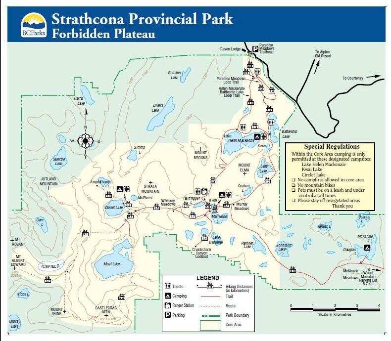
Forbidden Plateau on Vancouver Island is home to a network of quality BC Parks Hiking Trail.  This is the track for the main trail which runs to the summit of Mount Albert Edward.  Below is the BC Park's trail map for the area:

550712

Category: Strathcona Provincial Park 7 years ago
Chris Ludwig
Created 7 years ago

Like it on Facebook, Tweet it or share this track on other bookmarking websites.

Rate this track:

Not rated yet

Min Elevation
2003 m
Total Distance
14.58 km
Max Elevation
2003 m
Way Points
0
Total Elevation Gain
2003 m
Track Points
58
Total Elevation Loss
0 m
Values not available in the file may shown as 0.

This track was downloaded 13 time(s).

Please register/login to download this track.
Please wait while loading suggestions..

You have no rights to post comments

openstreetmap
400px
http://{s}.tile.openstreetmap.org/{z}/{x}/{y}.png
© OpenStreetMap contributors
Distance: {0} {2} Elevation: {1}
Distance: {0} {2} Speed: {1}
Distance: {0} {2} Heart Rate: {1}
Distance: {0} {2} Cadence: {1}
https://backcountrybc.ca/media/com_gpstools/markers/02marker.png
https://backcountrybc.ca/media/com_gpstools/markers/default.png
#0000FF
#c1392b,#ffbe00,#2d3e50,#27ae61,#74065f,#2998d8
0
3
50
google.maps.MapTypeId.TERRAIN
1
1
1
1
1
1
1
google.maps.ZoomControlStyle.DEFAULT
google.maps.MapTypeControlStyle.DEFAULT
Distance
Elevation
Speed
Heart Rate
km
mps
m
km
Miles
m
ft
mile/hr
ft/sec
km/hr
m/s
/index.php?option=com_gpstools&task=rating.rate&id=85&format=json