
- You are here:
-
Home

- Pinecone Burke Explorers
Pinecone Burke Explorers
Coquitlam-Squamish Hiking Trail Proposal
- Written by Paul Kubik
- Hits: 7772
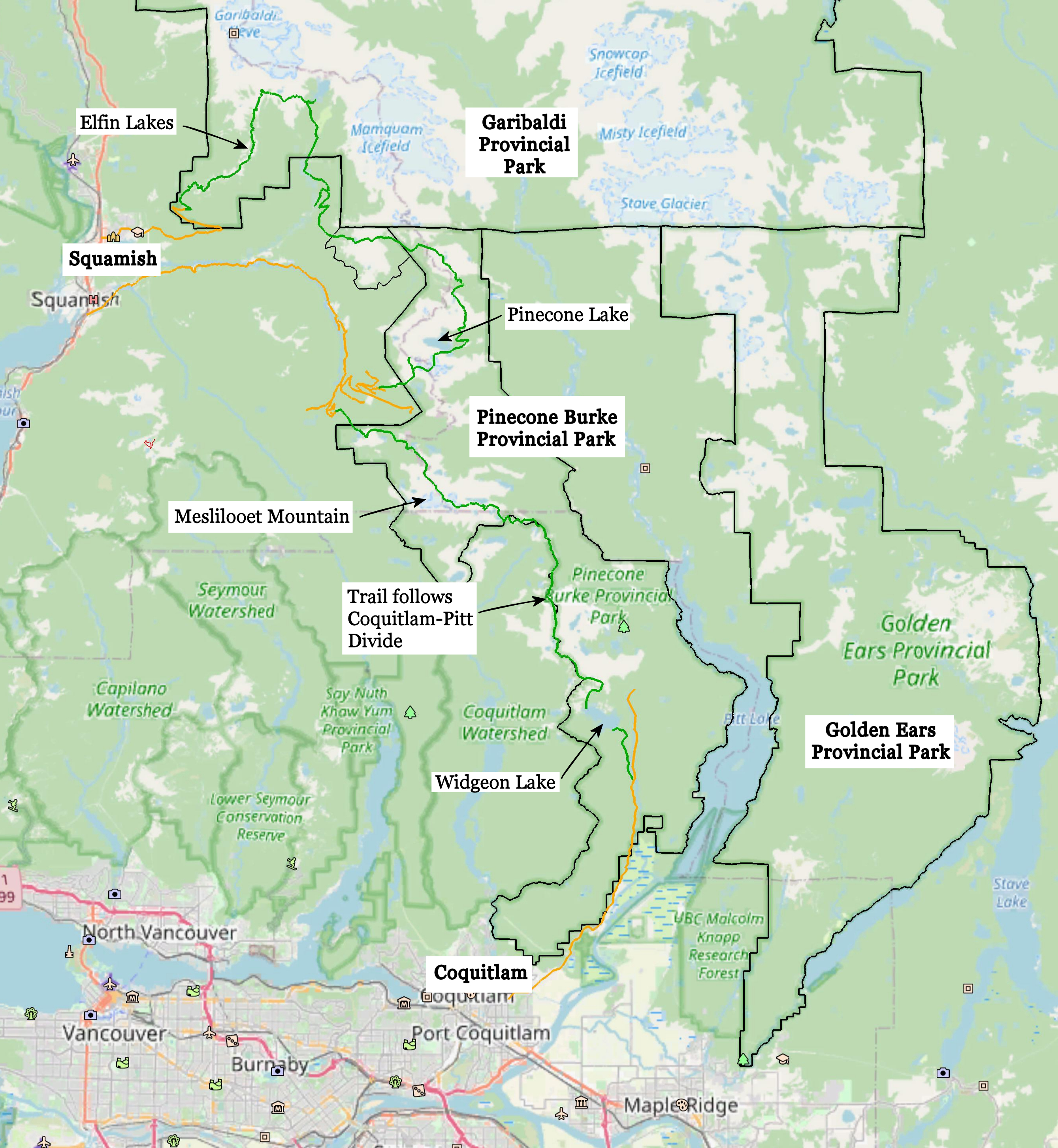
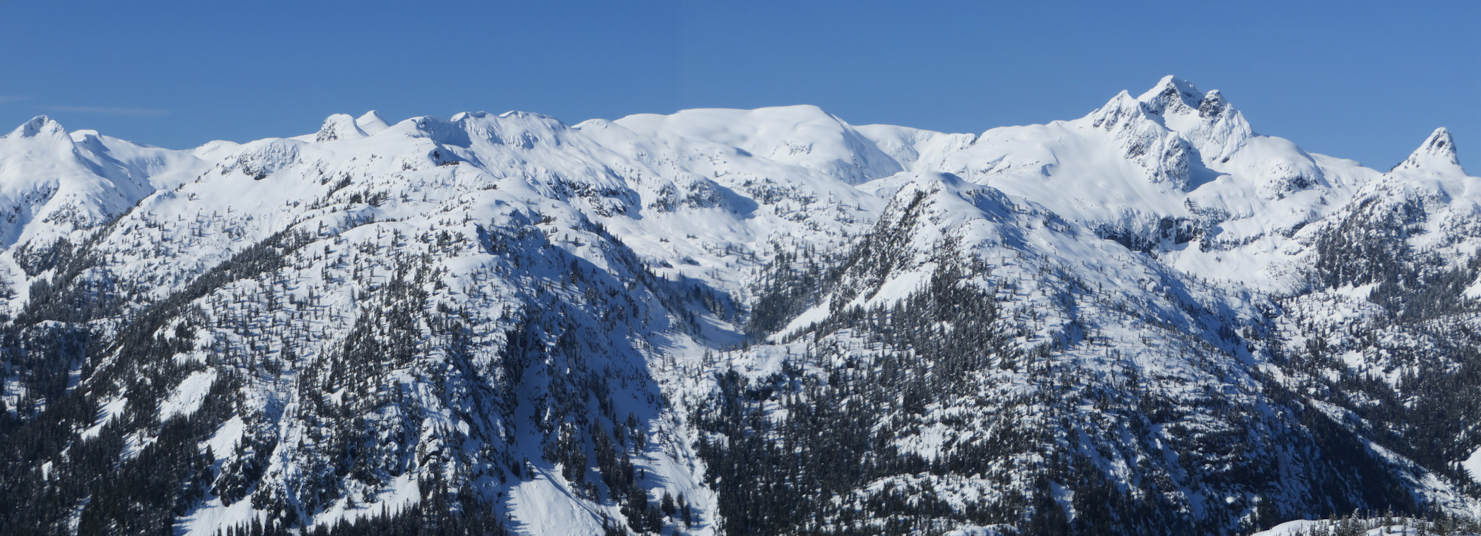
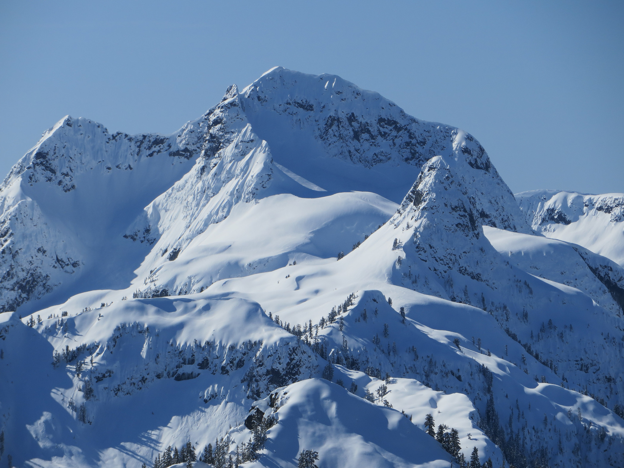
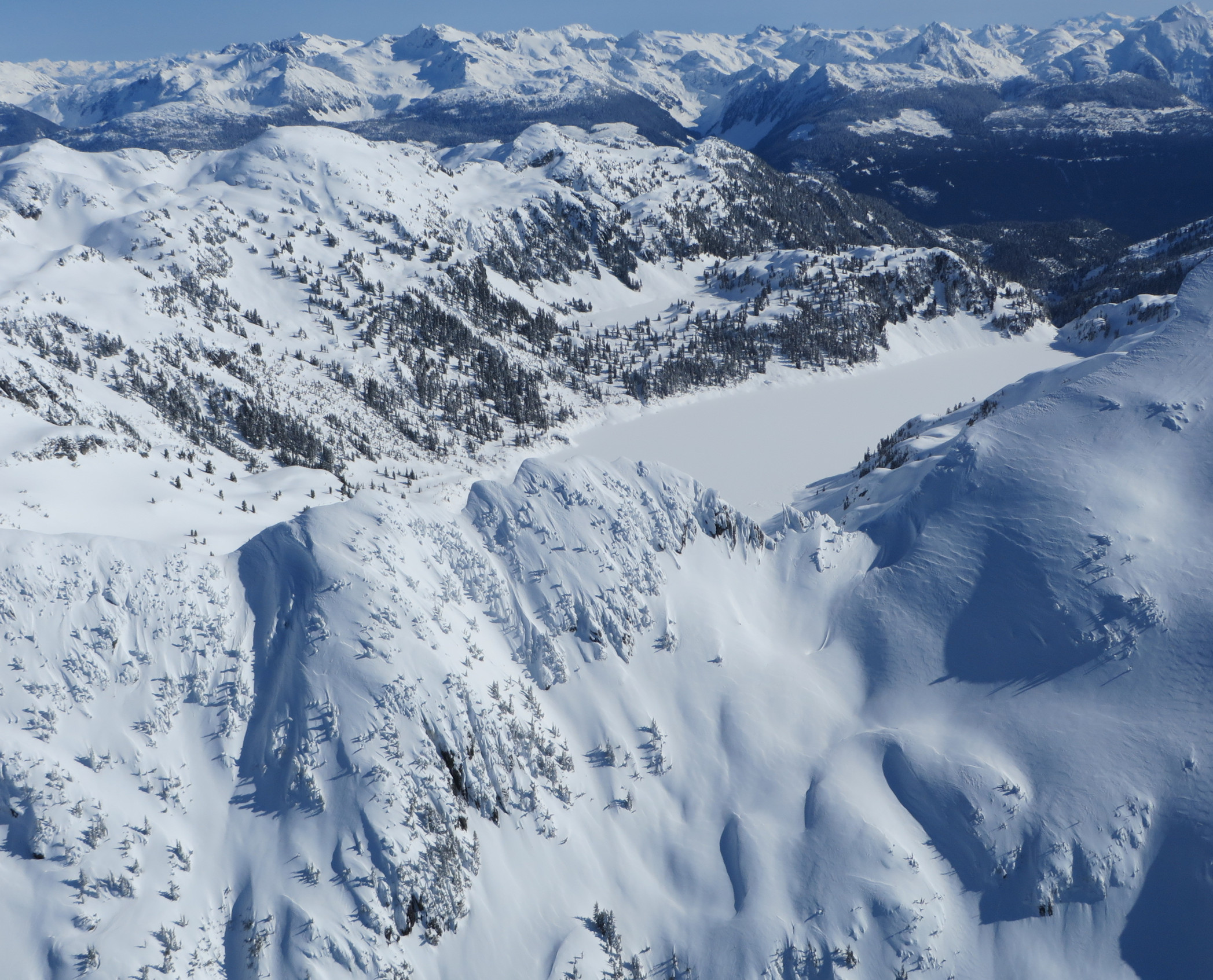
As part of longer range planning, it is highly desirable that a long distance hiking route between Coquitlam and Squamish be considered. Here we propose a high elevation trail that follows the Coquitlam-Pitt Divide north from Widgeon Lake. The divide provides hiking and mountaineering access to Meslilloet Mountain, the Five Fingers group of peaks and access to the ridgeline towards Peneplain Peak. Further north in the park, Pinecone Peak, Mount Gillespie and their connecting ridges to Crawford Peak all offer challenging and spectacular side trips from the proposed hiking route. The Opal Cone trail up Skookum Creek proposed in the Garibaldi Park southwestern amendment would be a key trail as there is no other trail connecting Pinecone Burke Provincial Park to Squamish.
Metro Vancouver is currently planning for public access to Widgeon Marsh regional park in the three to five year timeframe. This would further open up public access to the southern end of Pinecone Burke Provincial Park. A trail through the regional park will connect to the existing Widgeon Lake trail.
Concurrently, BC Parks is preparing a draft management plan for Pinecone Burke. Should the Garibaldi Park southwestern amendment proceed, it would mean that approximately 75 kilometers as the crow flies of provincial park land in southern British Columbia next to an urban metropolis is in a planning process.
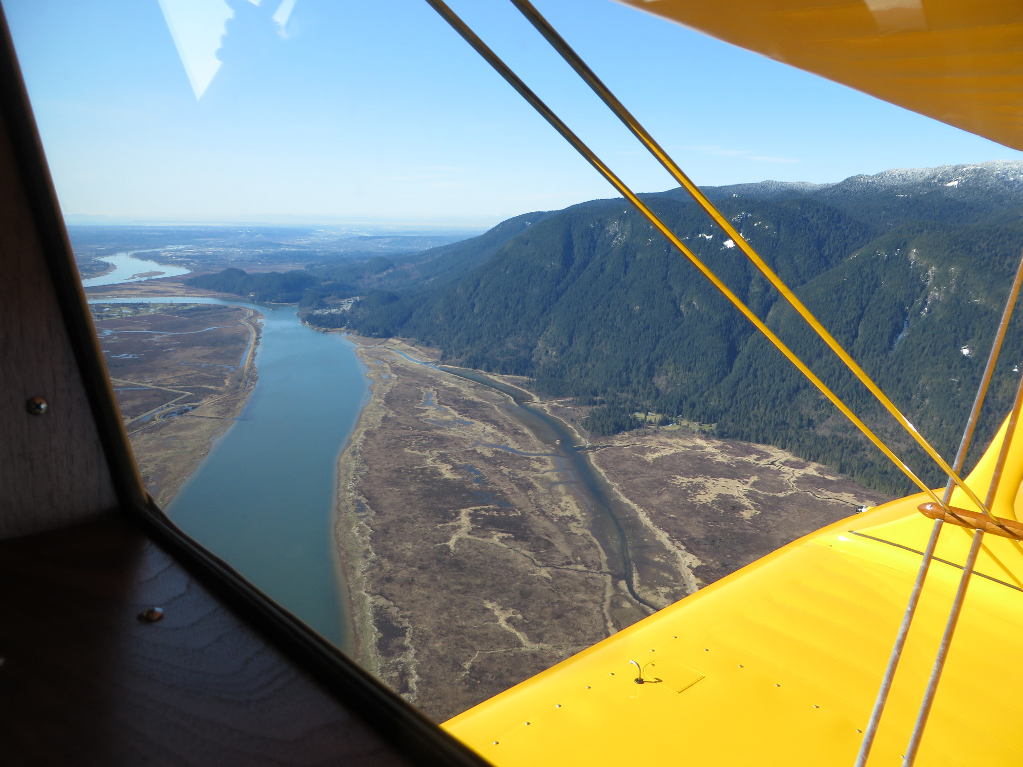
Currently, Widgeon Lake is difficult to reach. A boat is needed to cross Pitt River or it's necessary to hike over Burke Mountain. Widgeon Lake itself is an impediment to reaching the Coquitlam-Pitt divide. Steep cliffs run down to the lake. A float plane must be hired to land on the far end of Widgeon Lake. It is desirable to plan for a trail around the lake that would permit hiking access to the divide near Peneplain Peak.
Pinecone Burke Explorers—Welcome
- Written by Paul Kubik
- Hits: 5235
Explorers of Pinecone Burke Provincial Park—trails, routes, trip reports, beta and discussion.
For trip beta and discussion visit or join the Facebook group: Pinecone Burke Explorers
We invite people to submit their own trip reports within or near to Pinecone Burke Provincial Park. The idea is to provide information that will help people plan trips to the park in a sustainable manner and respecting the park values and regulations.
Subcategories
Pinecone Burke Access Article Count: 4
Pinecone Burke Trip Reports Article Count: 42
Would you like to author a trip report? We allow Authors to insert and edit their own trip reports. They cannot edit others.
We know that not everyone wants to go to a lot of trouble to write a report. Alternatively, you can always enter photos and a quick report on the Facebook group: Pinecone Burke Explorers group on Facebook
To author a trip report
You can request authoring privilege via the Request to be Author form. Ask to be added as a Pinecone Burke Explorer.
If you haven't already, you will first need to Create an Account on BackcountryBC. It is a free and open advocacy platform affiliated with the B.C. Mountaineering Club and sponsored by hiking organizations such as Vancouver Trails, Victoria Trails and Chasing Sunsrise.
Trip reports should be for trips within or very near to Pinecone Burke Provincial Park. We ask people to provide helpful information on access, trails, routes and conditions. Interesting observations, photos, maps and your personal perspective are most welcome. Try to think how your report will be useful to other people. Please be mindful that trip reports are not intended for dumping a bunch of photos on the site. We request a story and description as a minimum.