
- You are here:
-
Home

-
Community
-
Resources
-
Issues
-
Mainland / Southwest
-
Sea to Sky
- Skookum Valley / Mamquam
Skookum Valley / Mamquam
Issue Lead Advocate - Chris Ludwig
- Written by Chris Ludwig
- Hits: 5467
April 1, 2016
George Heyman, M.L.A. (Vancouver-Fairview) meets with the 2020 team
The 2020 team met with George Heyman in his Vancouver constituency office to introduce themselves and discuss the issues raised on the 2020 web site and GAS petition. Mr. Heyman is the Environment and Sustainable Energy critic of the NDP opposition in the provincial legislature.
- Written by Chris Ludwig
- Hits: 8036
March 22, 2016
FOI requests submitted by 2020
2020 submitted Freedom of Information requests comprising:
- Copies of the Heli-Skiing Park Use Permits/Agreements for Heli-Ski operations within Garibaldi Provincial Park.
- Copy of all the documents, letters, emails sent to and/or received from Squamish First Nation, or any other first nation pertaining to or mentioning the Darling Lake Trail, Darling Lake or Darling Ridge.
- Location - GPS coordinates - of all the mineral mountain goat licks discovered or documented on Darling Ridge or the Paranoid Creek Valley by government employees.
Our purpose in submitting the FOI requests is to determine the veracity of statements made by certain government officials in relation to the heritage Darling Lake Trail in addition to probing into the reasons for awarding heli-skiing permits adjacent to mountain goat winter range in the Spearhead Range.
- Written by Chris Ludwig
- Hits: 8192
Stop Work Order and Trespass Notice
| |
DarlingLakeTrailStopWorkOrder.pdf On August 26, 2015, the BCMC was served with a Stop Work Order and Trespass Notice delivered by registered mail and issued by Murray Watt, Compliance and Enforcement Officer of Ministry of Forests, Lands and Natural Resource Operations. |
2020 Commentary
The trespass notice contains what we consider major factual errors. Our position:
- The alleged impact on sensitive ecological sites is a complete fabrication. The trail does not approach Mountain Goat winter range. No evidence exists that the trail comes anywhere near mineral licks. The existence of mineral licks in Garibaldi Park has not been proven.
- The trail has been in existence for at least 20 years and the route in use for over thirty years. The Garibaldi Park 1990 Master Plan was deficient in not recognizing the trail. The Sea to Sky Land and Resource Management Plan of 2009 recognized the trail route as a major backcountry access route. Consultation with First Nations was not done because it is a more recent requirement. The trail has existed long before.
- The Garibaldi Park 1990 Master Plan did not put limits on the number of people entering the park. There is no management criteria that establishes a specific threshold number beyond which it is considered trespass. It is quite probably illegal for park managers to specifically discourage access to the park.
- The idea that the so-called Paranoid Creek is fish-bearing is fantastic considering the stream course over which the footbridge spans is bracketed both upstream and downstream by high waterfalls. No fish can pass upstream of the waterfalls.
It is also the position of the BCMC that the trail work was permitted under the FRPA, Part 3, Authorization not required subsection 2.
Part 3 — Unauthorized Trail or Recreation Facility Construction
Authorization under section 57 of the Act not required
3 (1) For the purposes of section 57 of the Act, the construction, rehabilitation or maintenance of a trail or recreation facility does not include
(a) marking a route with ribbons, cairns or other directional indicators, or
(b) minor clearing of brush, downed trees or repairs to a trail or recreation facility.
(2) Despite section 57 of the Act, a person may construct, rehabilitate or maintain a trail without the authorization of the minister if doing so is the only reasonable means of minimizing a risk to personal safety.
Stop Work Order posted on trail August 10, 2015
| |
StopWordOrder-ORCS-FileNo.23060-40.pdf In August 2015, Stop Work Order ORCS File No. 23060-40 was posted on the "connector trail" segment of Darling Lake Trail by Murray Watt, Compliance and Enforcement Officer of Ministry of Forests, Lands and Natural Resource Operations. |
2020 Commentary
The stop work order contains what we consider major factual errors. Our position:
- No trail building occurred in Garibaldi Provincial Park.
- No merchantable crown timber was cut. Only two trees of a diameter of 3 inches, no larger, one of which had a broken top, were cut.
- No unauthorized activity occurred in a park, conservancy or recreation area.
- Additionally, "making changes in and about a stream" is highly contentious.
Letter to Honourable Steve Thompson, Minister of Forests, Lands and Natural Resource Operations, RE: Stop Work Order at Paranoid Creek
| |
Letter_HonSThomson_BCMC_DarlingLake_MamquamIcefield.pdf In September 2015, the BCMC wrote to the Minister of Forests, Lands and Natural Resource Operations regarding the Stop Work Order posted by Murray Watt. |
Letter to Honourable Andrew Wilkinson from Chris Ludwig, August 10, 2015
|
Letter_HonAndrewWilkinsonDarlingLakeTrail.pdf Chris Ludwig, the BCMC Cabins and Trails representative at the time, wrote to Honourable Andrew Wilkinson in the provincial cabinet. |
Andrew Wilkinson was president of the BCMC in the early 1990s. Chris hoped to establish a dialogue with cabinet ministers to enable the Darling Lake Trail project to proceed.
Darling Lake Trail Rejection Letter
|
DarlingLakeTrailRejectionLetter.pdf The BCMC received an unsigned letter from Recration Sites and Trails BC dated August 11, 2015 that the Darling Lake Trail application was rejected. |
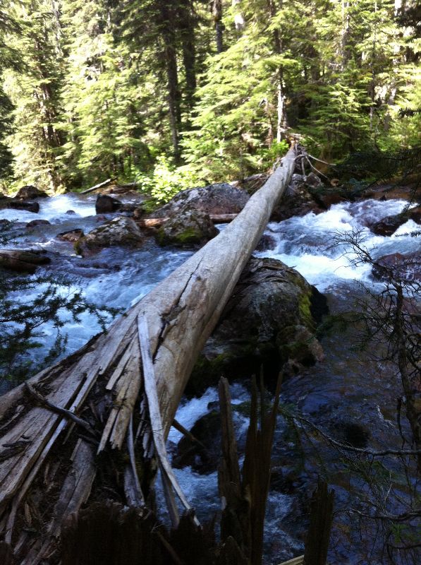
Photo: Crown timber allegedly felled by BCMC to bridge Paranoid Creek. The tree fell by itself across the creek. You can see the shattered base where it broke off.
Paranoid Falls Trail Rejection Letter
| ParanoidFallsRejectionLetter.pdf |
The BCMC recast the Darling Lake Trail application as the Paranoid Falls Trail application. It was realized that a formal Section 57 authorization under the FRPA was not going to happen while the 1990 Master Plan was in effect. Until it is changed, the Paranoid Falls Trail application was seen as a way to ensure public safety by upgrading the footbridge under Section 57. On December 15th, 2015 the club received a communication from (Name Withheld to protect Source) that Recreation Sites and Trails BC was not proceeding with the application.
2020 Commentary
- Volunteer trail builders and members of the public have a right to clear logging roads without formal permission from government.
- Secondly, it acknowledges that BC Parks and the Forest Office are making efforts to limit and obstruct public access to Garibaldi Park.
- It states that the Paranoid Falls Trail is of low recreational value, which is of course highly subjective (and comical considering the major interest in the trail). For example, one weekend in summer there were over a dozen people in the alpine area around Darling Lake.
Officer Watt's Goat Lick
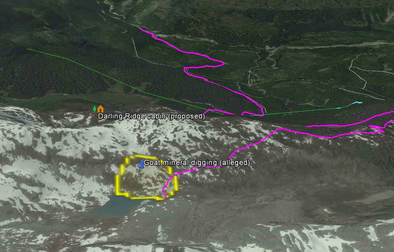
Officer Watt alleges there is a goat mineral lick on the south side of Darling Lake on granitic bedrock terraces.
- Written by Chris Ludwig
- Hits: 18762
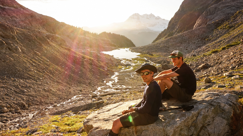
Heritage trail approaching the Mamquam Icefield and Mamquam Mountain from logging roads in Skookum Creek.
In spring and summer of 2015, the volunteer trailbuilders from the outdoor hiking and climbing clubs of Southwestern British Columbia held several large work parties and reestablished the trail. A scant few weeks later resource officers from the Enforcement Branch of Ministry of Forests, Lands and Natural Resource Operations descended on the trail. Stop work orders were posted. Volunteer Trail Builders were threatened with heavy fines and imprisonment. Flagging tape was removed and the volunteer trail builders were ordered to remove the hand cable. There was no clear justification for the orders. Unsubstantiated claims were made that goat herds were threatened by hiking activity and the trail impinged on goat winter range. Both allegations are completely false and unsubstantiated scientifically. The closest the trail approaches goat winter range is 800 meters. Suddenly, one then numerous high-quality mineral licks favored by goats were discovered all along the ridge by enforcement officers. Yet, there is no evidence of mineral licks along the trail route or even of goat passage. One would expect to see patches of snagged goat wool. It was alleged in the stop work order that the number of visitors exceeded some threshold number even though such a number had never been published nor sanctioned in the 1990 master plan. As time went on the unsubstantiated claims grew in number and became more wildly fantastic. BC Parks and FLNRO might as well have erected a giant "Do Not Enter - Park Visitors Not Welcome" sign at the entrance to the park. They are clearly in violation of the existing 1990 master plan. It contains no such restrictions on park visitor numbers.
At this juncture, the footbridge remains in place, albeit without a hand cable. The enforcement actions have not detered all that many people from hiking the trail. We fear that parks and the enforcement branch would welcome a fatality at the creek crossing if it were to discourage park visitation.
Click Here for Gmap Rendering (of the Darling Lake Heritage Trail)
Heritage
The trail has existed at least prior to 1983 and probably earlier. The VOC published A Guide to Ski Touring in the Lower Coast Range in 1983. The trail route is shown on the map on page 30 of Mamquam Mountain. See the article here: MamquamMountain-VOCSkiGuide1983.pdf. The trail is again referenced in Bruce Fairley's A Guide to Climbing & Hiking in Southwestern British Columbia published in 1985. See page 50, Routes, Mamquam Mountain, From the Mamquam River. The quote below is germane to the trail.
Skookum Creek roads lead to a bridge across the east fork of Skookum Creek at 880m... Various parties have flagged routes into the [Darling Lake] valley over the years, and some parties have started at the bridge and climbed straight up onto the ridge to the NE [Darling Ridge] to reach the valley. (Ref: VOC Ski Guide, p. 48)
The trail became difficult to reach after Skookum Creek roads were deactivated by Ministry of Forests in the late 1990s. Attempts by members of the outdoor hiking and climbing clubs to keep the road open were insufficient and the access road lapsed into a slide alder hell. With the completion of the Skookum Creek IPP around 2014, the old Skookum logging road next to the creek was rebuilt a distance of 7 kilometers to the newly constructed Skookum dam.
In spring and summer of 2015, large work parties of the outdoor hiking and climbing clubs of Southwestern BC cleared the road from the dam and reflagged the heritage trail up Darling Ridge. The old trail tread and flagging was still clear and easy to follow. The old footbridge had rotted but was clearly visible on the far side. A naturally fallen cedar log was equipped with stainless steel handcable and the trail was declared open.
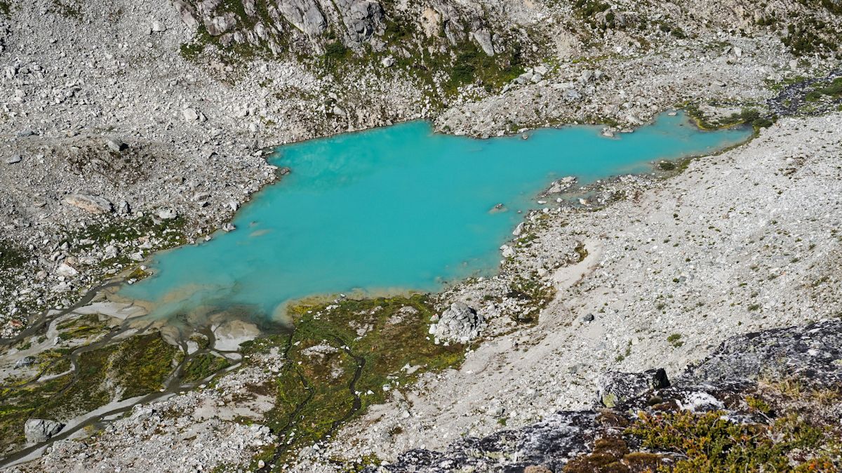
Photo: Darling Lake from the ridge
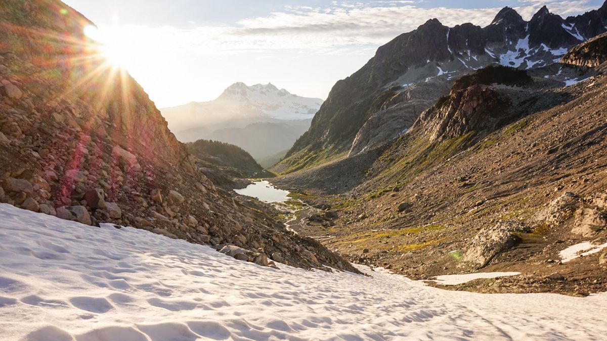
Photo: Darling Lake from the head of the valley
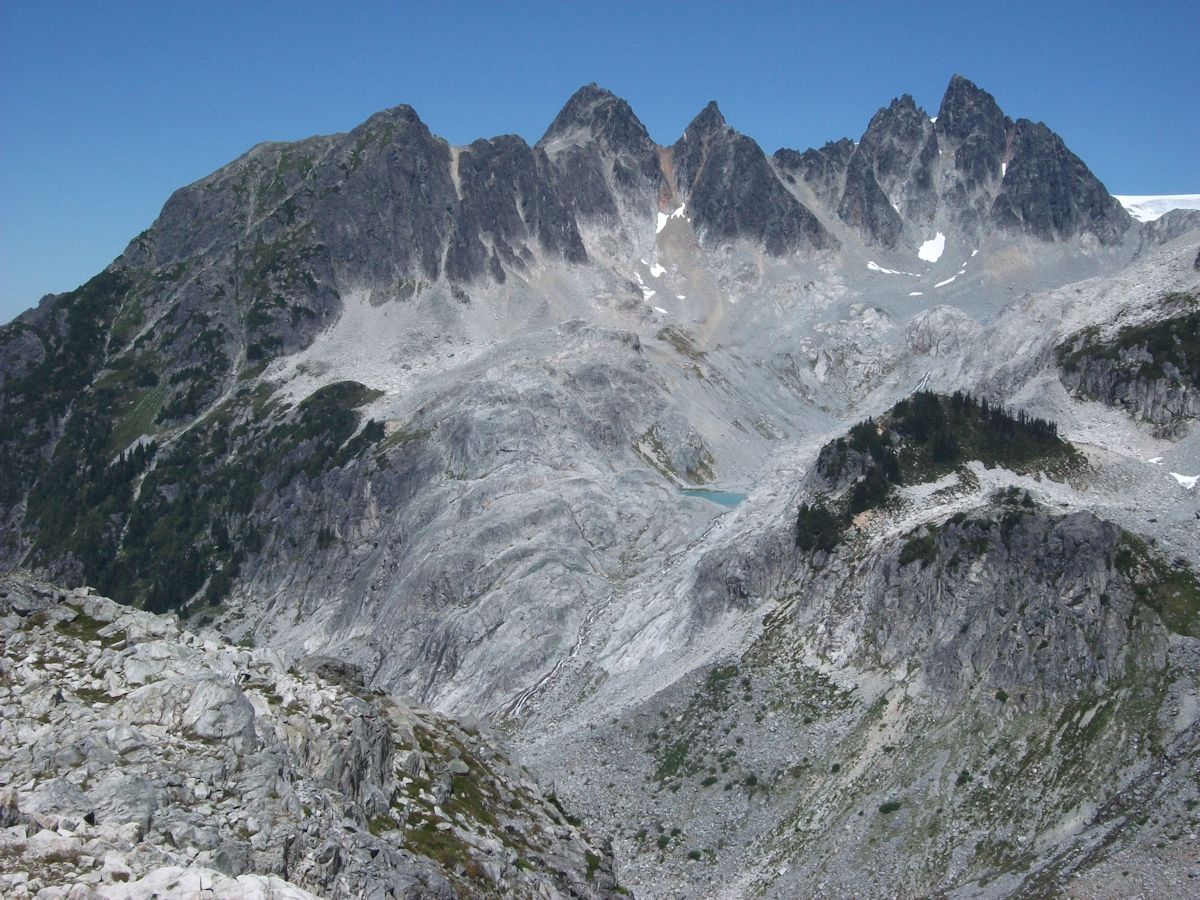
Photo: Darling Peak from high on Darling Ridge. The route to Mamquam Icefield passes the lake in front of Darling Peak.
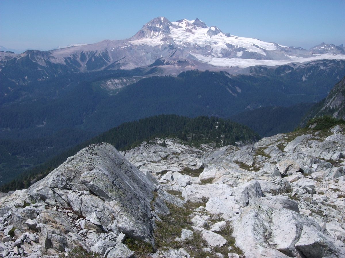
Photo: Looking down Darling Ridge. Mount Garibaldi far center and Opal Cone in front. Zig Zag Creek is the U-shaped glacial trough in front of Opal Cone. Mamquam Lake is far right.
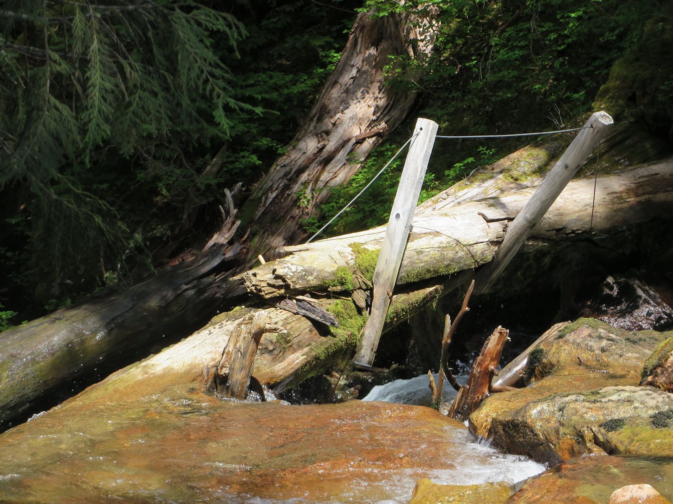
Photo: The remains of the footbridge across Paranoid Creek used in the 1990s
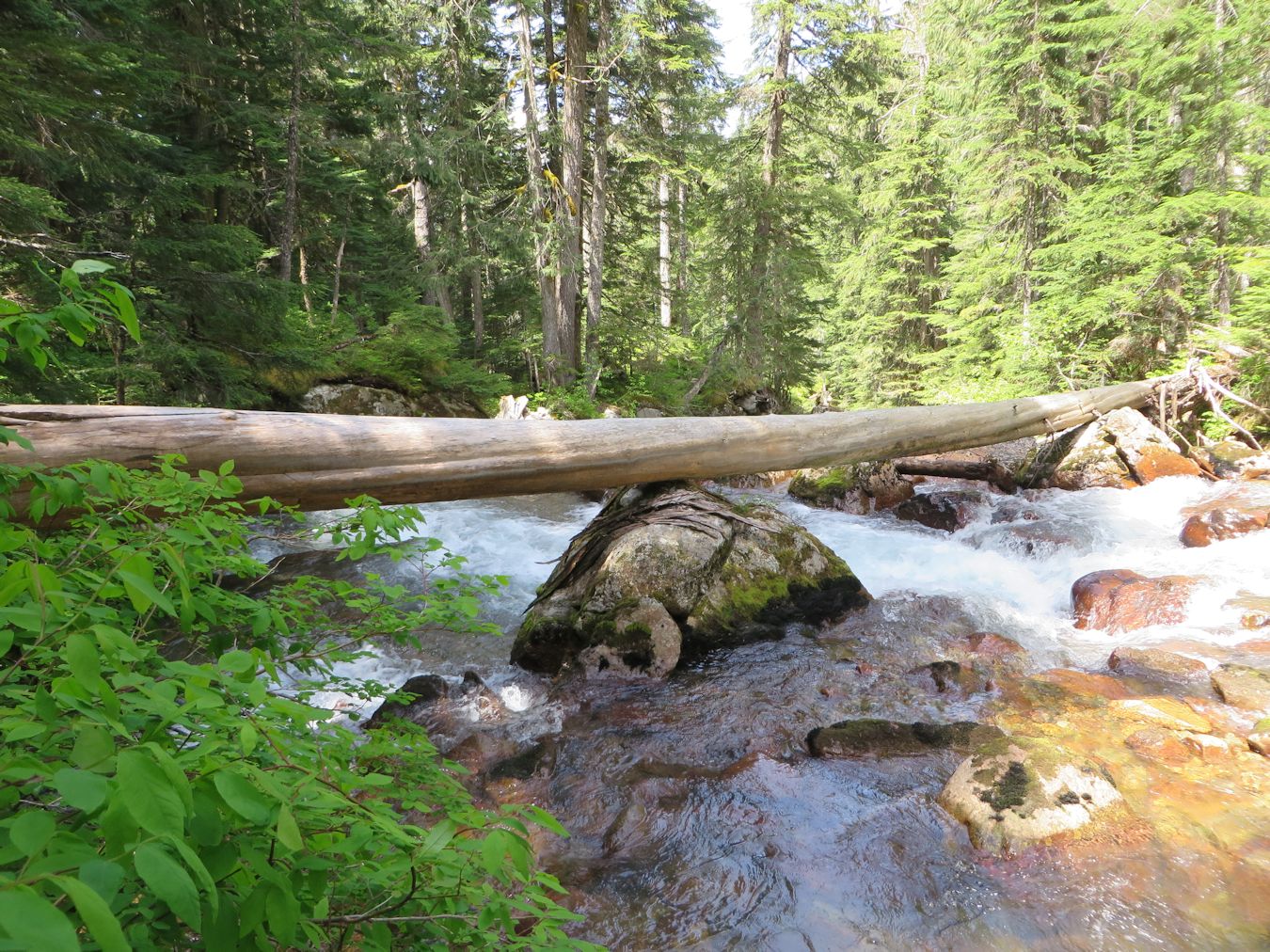
Photo: The new crossing upstream of the falls - a naturally fallen yellow cedar log supported midstream on rocks
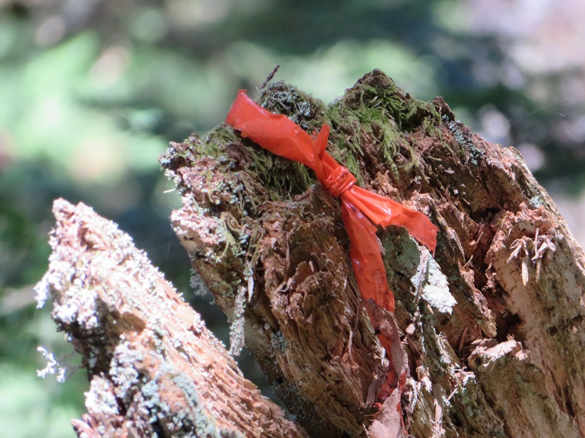
Photo: Heritage flagging tape on the Darling Lake Trail. Flagging tape, both new and old, was removed in August 2015, in an attempt to obfuscate access. Fortunately, most parties have GPS these days.
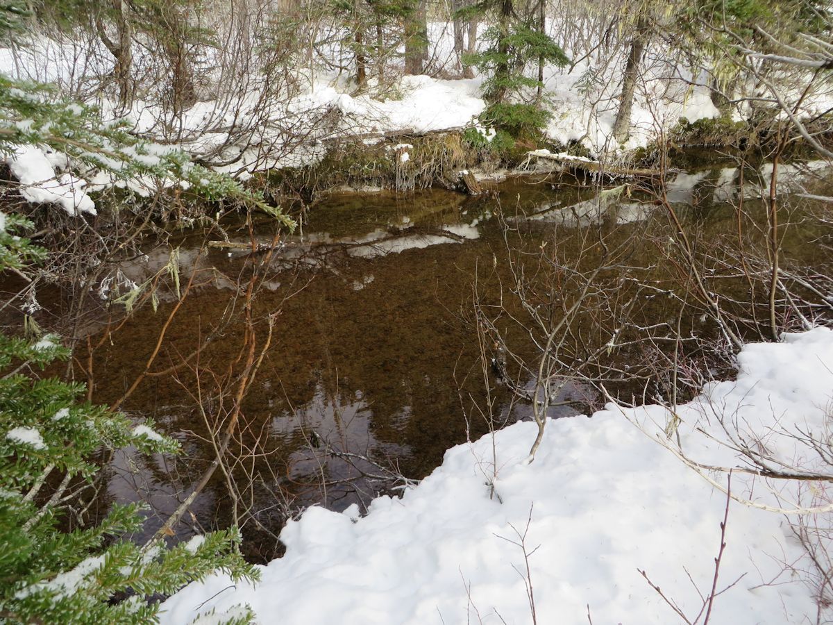
Photo: An alternative crossing is reached at the outlet of the large swamp on Paranoid Creek. A gentle stream flow over small gravel bed is conducive to crossing on foot.
To reach the swamp, bushwhack upstream of the footbridge. Keep well away from the creek by following near the spine of rock southwest of the creek. The swamp is about 800 meters distant and 100 meters higher than the footbridge. The bushwhacking grade is easy to moderate. Do not proceed further up the swamp. It is extremely hard going with deep bog, slide alder and braided creeks. The main creek channel pinches the route out at a cliff. Rather, cross near the outlet of the swamp and bushwhack back to the Darling Lake Trail.