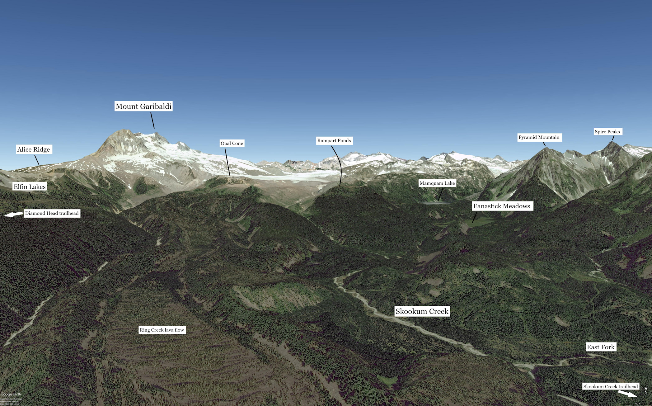
Google Earth rendering of an oblique view looking north up Skookum Creek to Mount Garibaldi, Opal Cone and Mamquam Lake. There is a proposed trail from the Skookum Creek trailhead to Opal Cone. It would provide connectivity to the Diamond Head trailhead.
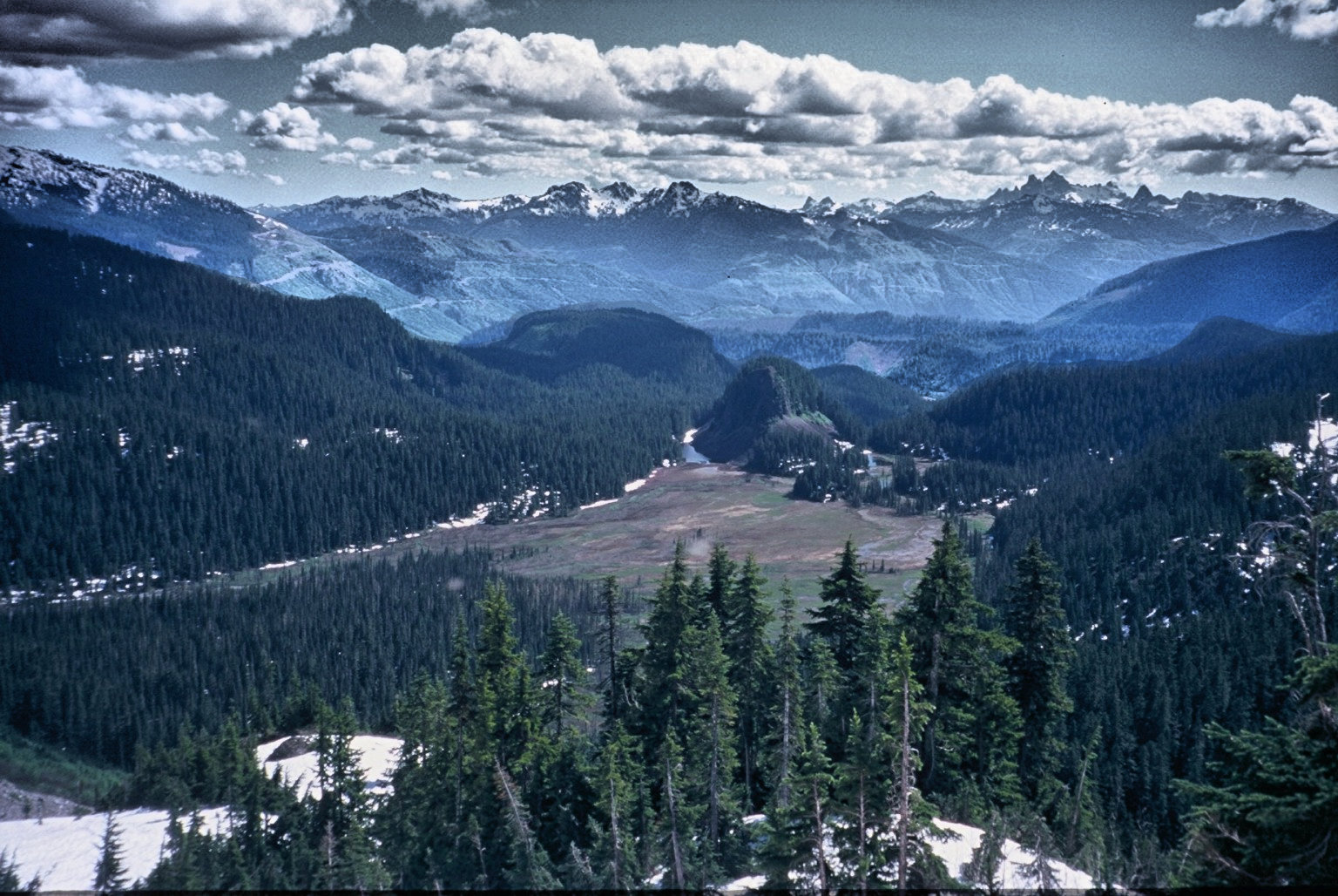
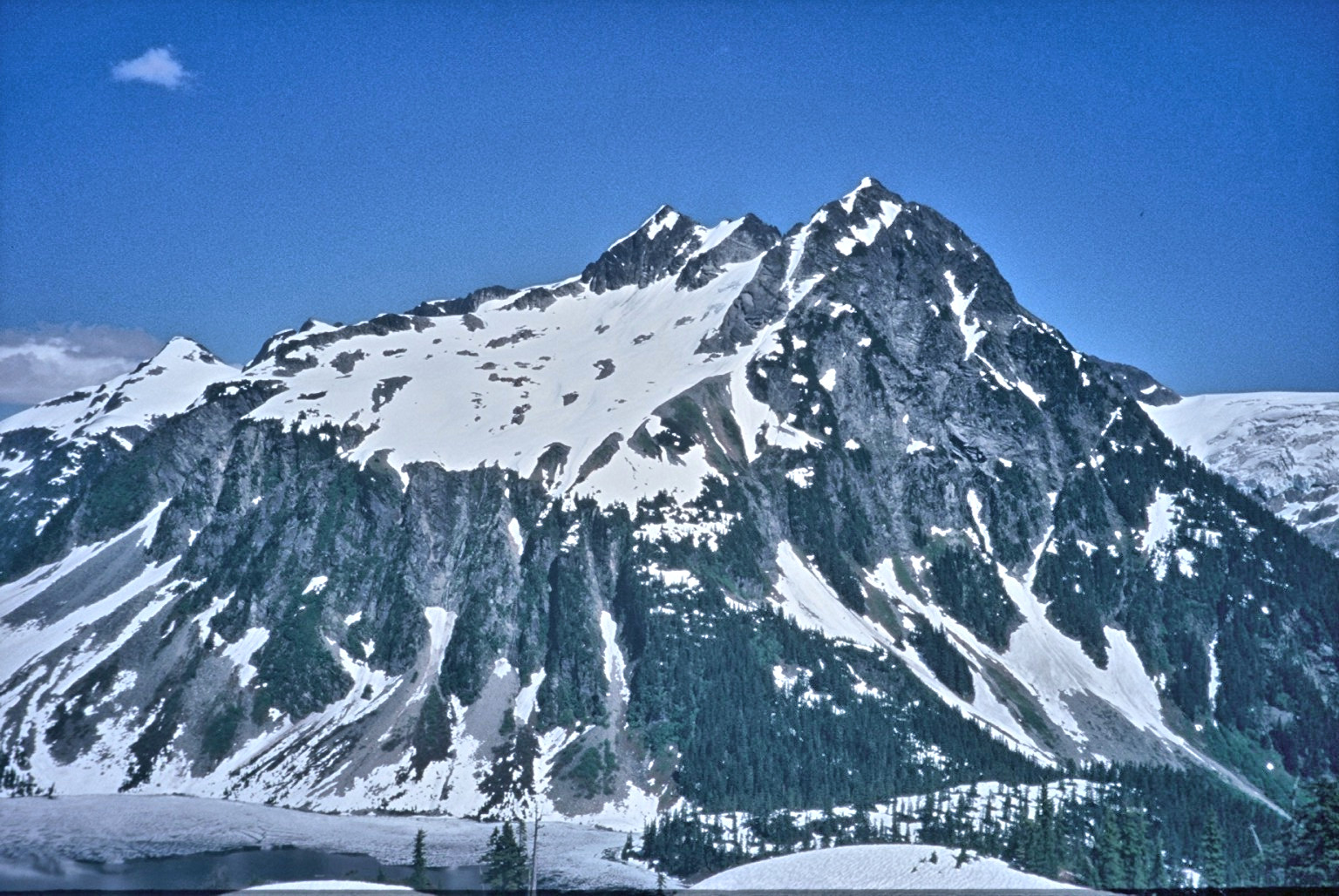
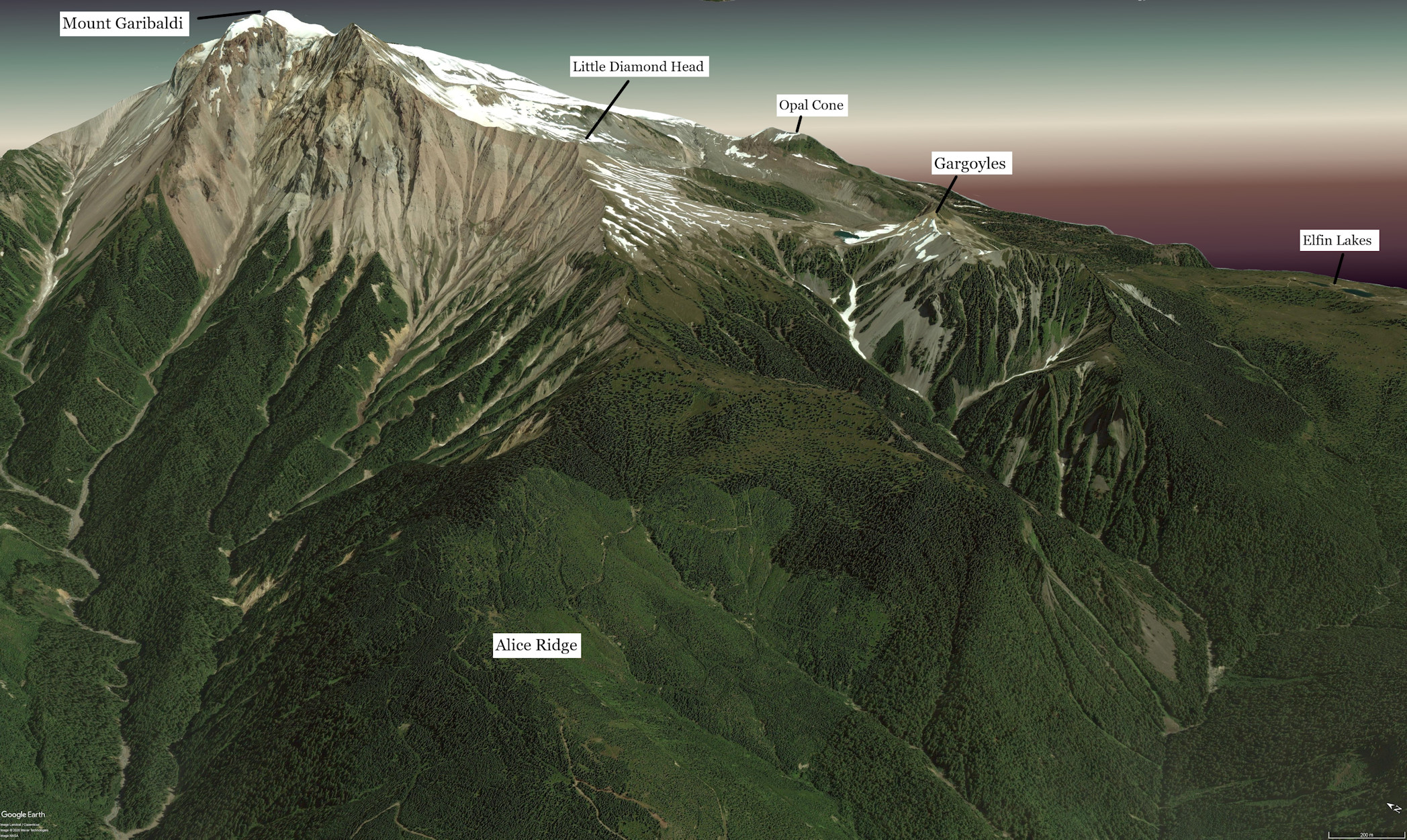
Looking south across Eanastick Meadows and down Skookum Creek. The meadows are created by a volcanic plug that dams the outwash from Pyramid Mountain and Spire Peaks to create a meadow. The term "meadow" is more of a misnomer as the flat-lying land is alluvium covered by a willow thicket. Looking east across Mamquam Lake to Pyramid Mountain and Spire Peaks behind. The peaks are of interest to mountaineers. The photo is taken from the vicinity of Rampart Ponds campsite. Google Earth rendering of an oblique view looking east along Alice Ridge. It is proposed to re-establish the trail along Alice Ridge to Little Diamond Head. The existing trail over the Gargoyles would provide connectivity to Elfin Lakes and the Diamond Head trailhead.