Backcountry BC
Backcountry BC
  • Home
    • About
    • Recent Articles
    • Recent Documents
    • Latest Tracks/Trips
  • Issues
    • Active Campaigns
    • Mainland / Southwest
    • Vancouver Island/Coast/Gulf Islands
    • Thompson - Okanagon
    • Kootenay
    • Cariboo
    • North Coast / Nechako
    • Northeast
    • Province Wide
    • BC Region Boundaries
  • Documents
    • Document and File Repository
    • Advanced Site Search
    • About the Document and File Repository
  • Proposals
    • Garibaldi Southwest Amendment
    • Coquitlam to Squamish Trail
  • Maps and Media
    • Custom Maps
      • Mamquam Custom Map
      • Brohm Ridge Custom Map
      • Singing Pass Custom Map
      • Spearhead Heli-skiing Custom Map
      • Garibaldi Park Wilderness Conservation Zone
      • Garibaldi Park Whistler-Blackcomb Deletions
      • Pinecone Burke Proposed Trails
      • Watersprite Custom Map
    • Mapping Data Repository
    • Resource/Trip Planning Maps
      • BC Mountain Specific Weather
      • BC Dynamic Weather Map
      • BC Avalanche Forecast
      • Backroadstatus Dynamic Map
      • BC Strava Heat Map
      • Crown Land Use Application Dynamic Map
      • BC Environmental Assessment Dynamic Map
      • High Elevation Weather Station Dynamic Map/Webcams
      • BC Parks Dynamic Map
      • Forest Service Road Dynamic Map (not maintainted)
    • GPS and Mapping Tools
      • WTracks GPX Editor
      • CalTopo GPX Edit and Render Tool
      • Additional GPX/KML Tools
      • Render GPX File in Open Topo Map
    • Photo Galleries
    • Videos Galleries
  • Resources
    • Trails Database
    • Trails Database Overview Map
    • Reference Articles
    • FAQ
    • Privacy Policy
    • Terms of Use
  • Contact

Garibaldi Park Wilderness Conservation Zone

  1. You are here:  
  2. Home
  3. Maps and Media
  4. Custom Maps
  5. Garibaldi Park Wilderness Conservation Zone

Garibaldi Park Wilderness Conservation Zone

Garibaldi Park Wilderness Conservation Zone

Written by: Paul Kubik
Created: 24 September 2016
Hits: 8792

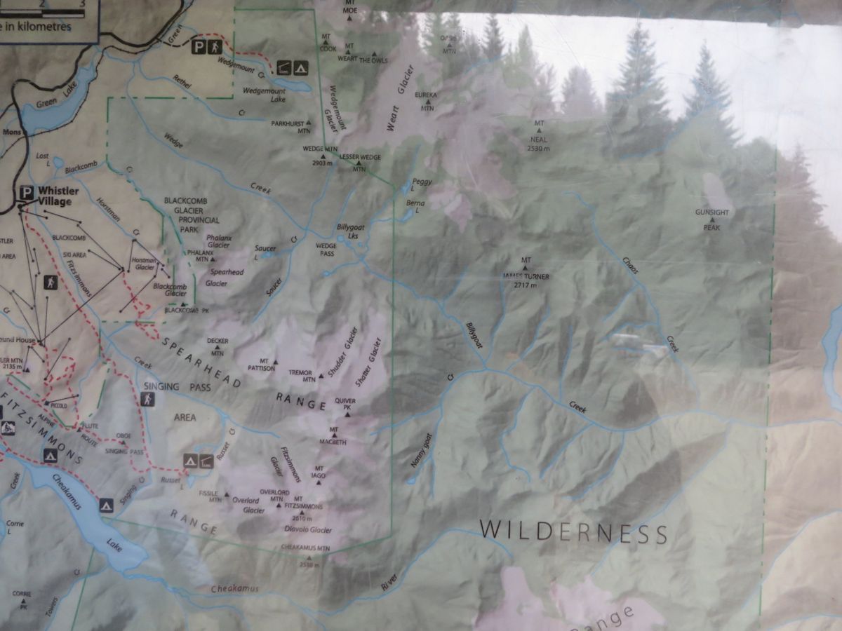
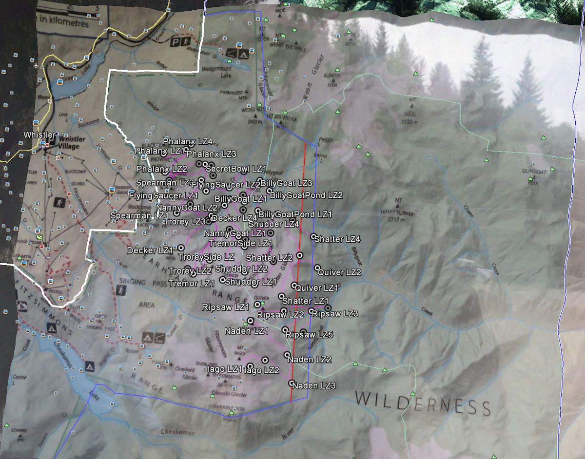
The following maps pertaining to the Garibaldi Park Wilderness Conservation Zone and the Whistler Heli-Ski Park Use Permit are constructed from BC Park's own map of the wilderness conservancy posted at the Elfin Lakes Trailhead.  The BC Parks map of the Wilderness Conservation Zone suggests that the conflict between Heli-Ski Operations in Garibaldi Park and the Wilderness Conservation Zone is much worse than previously mapped and understood by Garibaldi Park 2020.

The blue line represents the wilderness conservation zone as previously mapped by Garibaldi Park 2020.

The Red line represents the wilderness conservation zone as represented by the BC Parks Map.  Note that this adds an additional two helicopter landings zones into the Wilderness Conservation Zone of Garibaldi Park.

The Purple Shaded Area is the Whistler Heli-Ski Tenure.

Map Files:

Wilderness Conservancy Zone Map
Spearhead PUP Overlay1 Map
Spearhead PUP Overlay2 Map

SpearheadPUPOverlay2

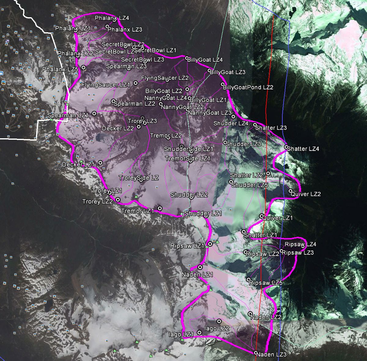
The Heli-Ski Tenure Overlaid onto BC Park's own map:

SpearheadPUPOverlay1 

The Original, BC Parks Map as photographed at the Elfin Lakes Trailhead.

WildernessConservancyZone