×
Search
Home
About
Recent Articles
Recent Documents
Latest Tracks/Trips
Issues
Active Campaigns
Mainland / Southwest
Vancouver Island/Coast/Gulf Islands
Thompson - Okanagon
Kootenay
Cariboo
North Coast / Nechako
Northeast
Province Wide
BC Region Boundaries
Documents
Document and File Repository
Advanced Site Search
About the Document and File Repository
Proposals
Garibaldi Southwest Amendment
Coquitlam to Squamish Trail
Maps and Media
Custom Maps
Mamquam Custom Map
Brohm Ridge Custom Map
Singing Pass Custom Map
Spearhead Heli-skiing Custom Map
Garibaldi Park Wilderness Conservation Zone
Garibaldi Park Whistler-Blackcomb Deletions
Pinecone Burke Proposed Trails
Watersprite Custom Map
Mapping Data Repository
Resource/Trip Planning Maps
Dynamic Maps Reference Article
GPS and Mapping Tools
BC Mountain Specific Weather
BC Dynamic Weather Map
BC Avalanche Forecast
High Elevation Weather Station Dynamic Map/Webcams
BC Parks Dynamic Map
Photo Galleries
Videos Galleries
Resources
Trails Database
Trails Database Overview Map
General Reference Articles
FAQ
Privacy Policy
Terms of Use
Contact
Pelion Mountain Ice Loss 2014 to 2020
You are here:
Home
Issues
Province Wide
Environment
Climate Change
Pelion Mountain Ice Loss 2014 to 2020
Pelion Mountain Ice Loss 2014 to 2020
Written by:
Paul Kubik
Created: 30 July 2020
Hits: 3969
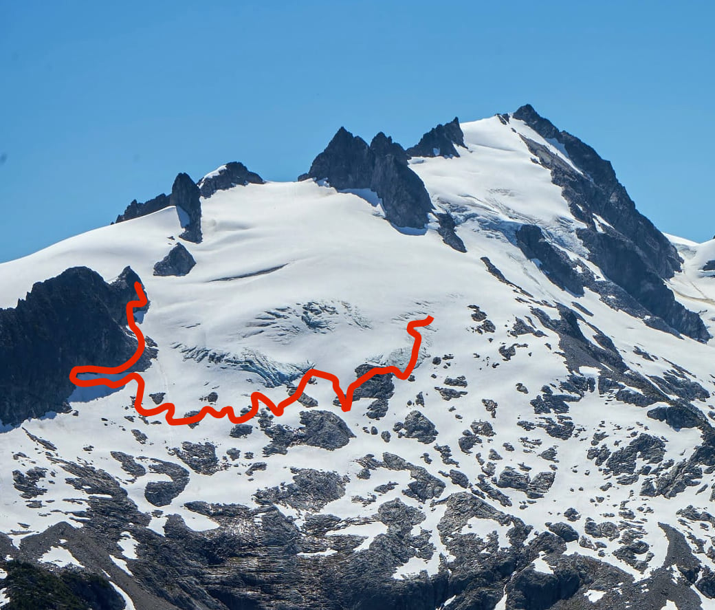
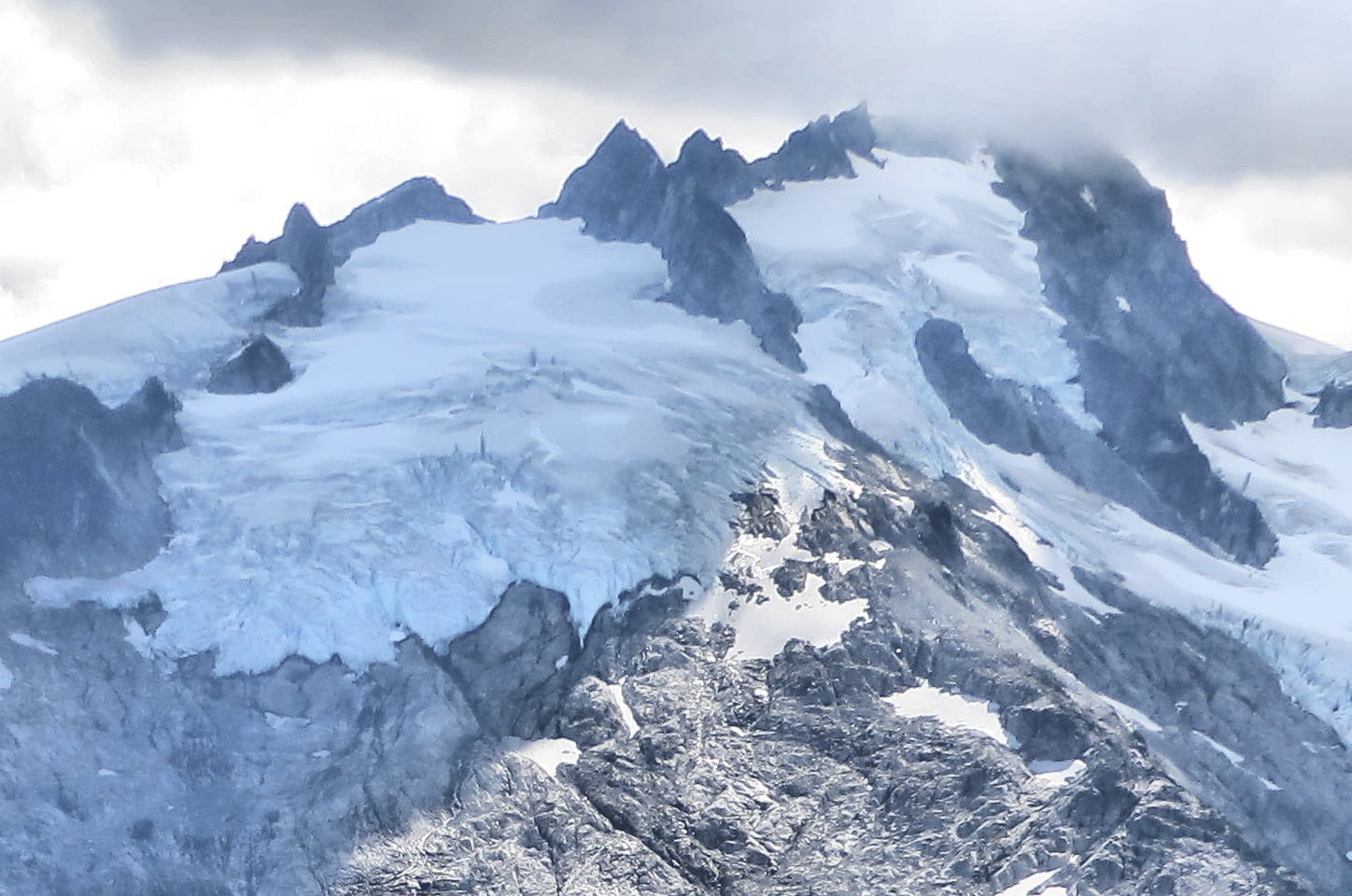
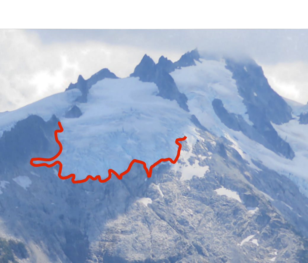
PELION MOUNTAIN ICE LOSS 2014 TO 2020
Two pictures taken six years apart show the amount of ice loss on one flank of Pelion Mountain.
Previous article: Proposed carbon-zero ski resort has B.C.’s fiercest nature lovers worried it’s all downhill from here
Prev
Next article: Disappearing climates in the Garibaldi park complex between 1980 to 2100
Next