Warren Glacier Area Images
- Written by: Paul Kubik
- Hits: 3021
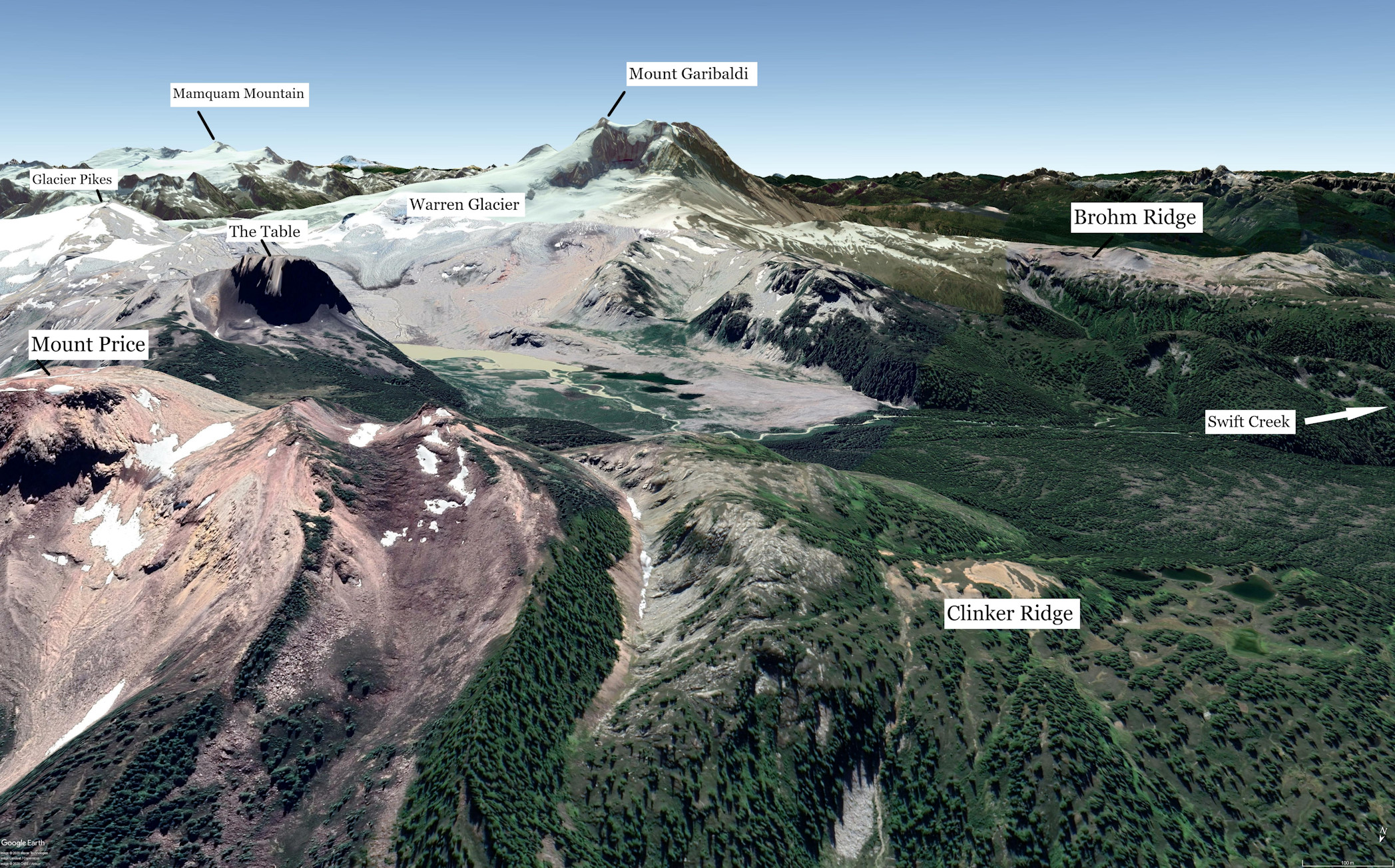 Google Earth rendering of an oblique view looking south from above Clinker Ridge showing the Warren Glacier area of the southwestern amendment. It is bounded on the south by Brohm Ridge and Mount Garibaldi, on the east by Glacier Pikes and on the north by Clinker Ridge. Warren Glacier flows down the north side of Mount Garibaldi. The proposed Swift Creek trailhead off Sea to Sky Highway is off to the west on the righthand side.
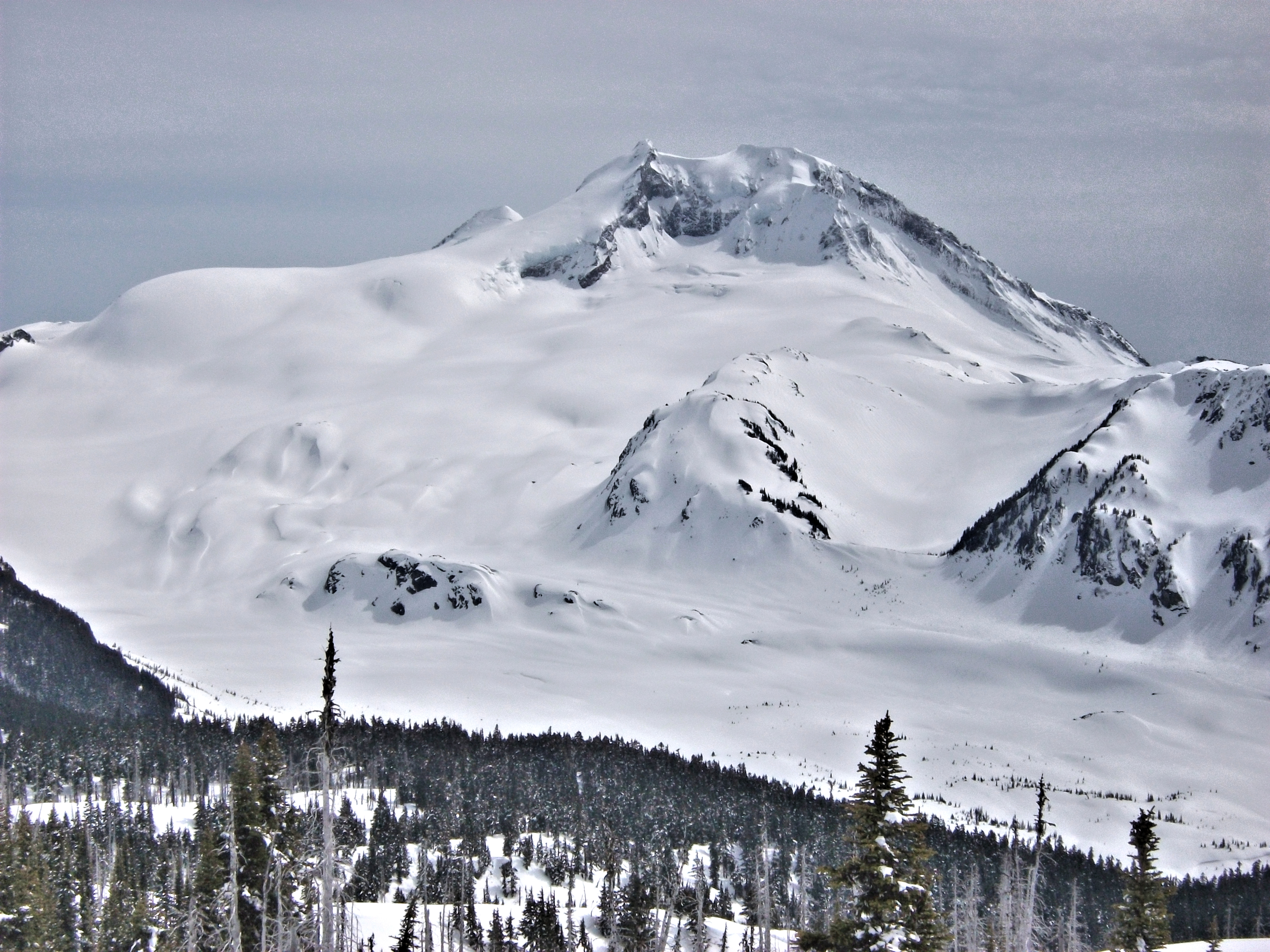 Mount Garibaldi from Clinker Ridge looking south. On the left is Warren Glacier. On the right is Brohm Ridge. The trail from Brohm Ridge would come down the spur of rock in the centre. The proposed cabin and campsite would be in the flat outwash plain of the glacier.
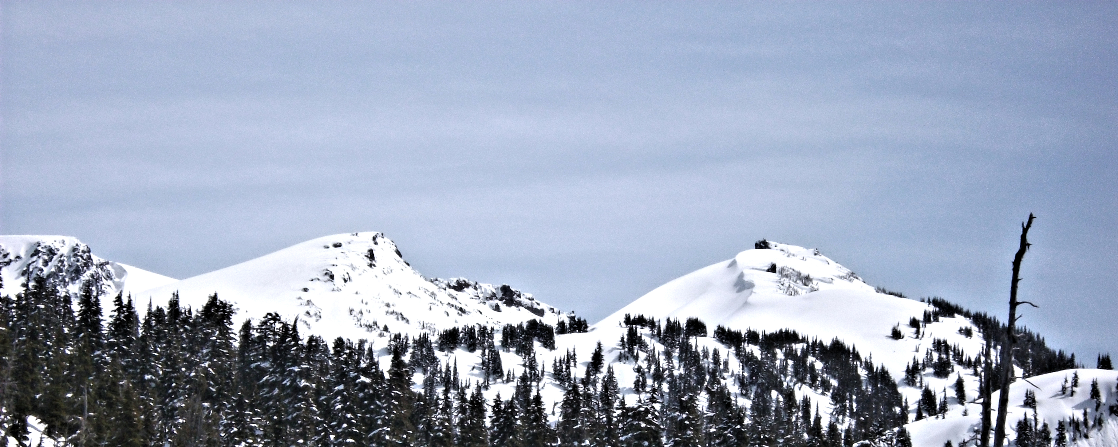 Looking east up Clinker Ridge. Clinker Peak in the centre. Mount Price on the far left in the background. A route would be marked by rock cairns between Clinker Ridge and the Mount Price trail. The route would provide connectivity between Brohm Ridge and Rubble Creek.
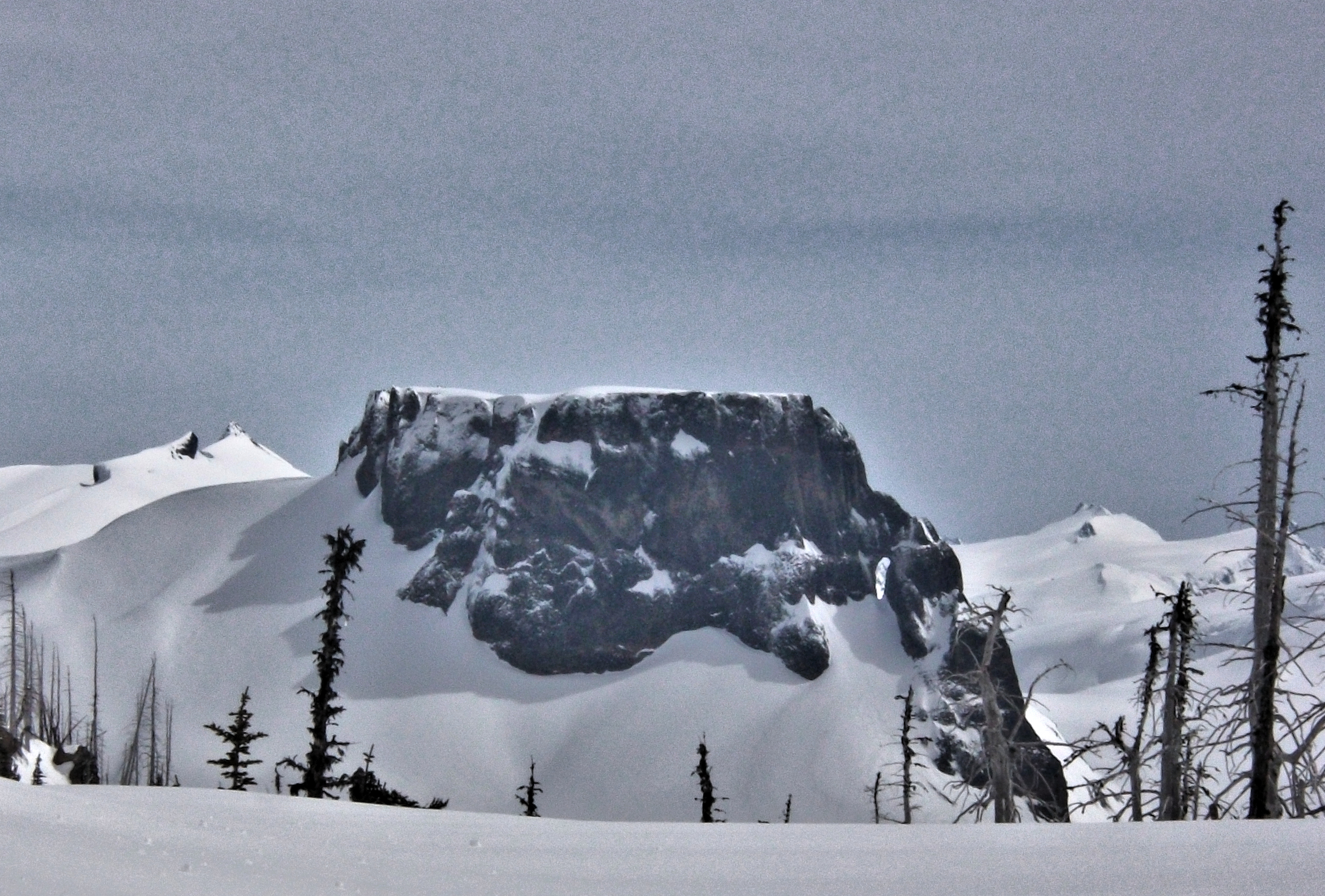 The Table from Clinker Ridge. Note the prominent "Teacup Handle" looking through to the background. Glacier Pikes is about 6 km away on the left. Mamquam Mountain is over 20 km away on the right.