November 15, 2017
Whistler Blackcomb has raised alarmist predictions that public parking up Fitzsimmons Creek would lead to wildfires on Blackcomb Mountain. Wildfire prevention practices used in Cheakamus Community Forest and Resort Municipality of Whistler are applicable in Fitzsimmons Creek.
Risk from public access is manageable by what is called stand thinning according to programs dubbed "fire smart" in British Columbia. To date, no stakeholders, be it Whistler Blackcomb, Whistler Sliding Centre or the Province, have followed this fire prevention practice in Fitzsimmons Creek.
At a public open house October 27th in Whistler on wildfire prevention in Cheakamus Community Forest, Jeff Fisher, registered professional forester, at Sqomish Forestry LP explained how it works. Deciduous and large trees are not harvested. Rather, the stands are thinned to a spacing of between 230 and 350 trees per hectare. It leaves enough shade to reduce underbrush while making it hard for fire to jump from tree to tree. Skilled employees from RMOW, Lil'wat and Squamish Nations do the work.
More information on the open house is available in this Pique newsmagazine article: Wildfire prevention top of list for CCF in 2018
Dr. Michael Feller, a retired UBC forestry professor, states it is also necessary that the thinning slash be removed.
In January, RMOW released its Wildfire Protection Strategy to the public. In the strategy, it states "fuel thinning projects reduce the ability of fire to spread from the forest into the community and vice versa, while maintaining a healthy forest ecosystem." Surface erosion, sedimentation and potential debris flows can last decades following a wildfire according to the strategy.
The section of Fitzsimmons Creek proposed for public parking lies entirely within the RMOW boundary. This is the road and weir that services the Innergex power project on the Blackcomb side. The road on the Whistler side is the Singing Pass trail designated as a recreation trail under Section 56(1) of the Forest and Range Practices Act. A secondary objective of the wildfire protection strategy is to "protect critical infrastructure and facilities in Whistler." When the parking lot and footbridge across Fitzsimmons Creek is in place, our interpretation is that both the power project and trailhead facilities would constitute critical infrastructure along with assets of Whistler Sliding Centre and Whistler Blackcomb in the area.
The wildfire protection strategy shows the roaded areas of Fitzsimmons Creek (see map below) as predominantly areas of C3 and C4 fuel types both of which are considered hazardous.
The C3 fuel type is characterized by fully stocked, late young forests with crowns separated from the ground. Fires occurring under high wildfire danger levels are generally surface and crown fires with low to very high fire intensity and rate of spread. Finally, the C4 fuel type is characterized by dense pole-sapling forest and young plantations with heavy standing dead and down, dead woody fuel accumulation and continuous vertical crown fuel continuity. Under high wildfire danger level, wildfire behaviour for this fuel type is almost always crown fire with high to very high fire intensity and rate of spread.
The wildfire protection strategy designates the upper portion of Fitzsimmons Creek as a Priority 2 area. Priority 1 areas are within 500 meters of structures and are highest priority.
In terms of funding the strategy, the report suggests it would take 60 years at current funding levels to tackle just the Priority 1 areas using the current level of funding available to RMOW. However, Priority 2 areas could be addressed using another funding stream. A funding stream is available for Landscape fuel breaks on Crown land that typically do not qualify for funding by Union of BC Municipalities members such as RMOW.
[It] is the Forest Enhancement Society of BC (FESBC) Forest Enhancement Program (FEP). The qualification and prioritization of wildfire risk reduction/mitigation projects for FESBC funding is less restrictive than the [UBCM Strategic Wildfire Prevention Initiative] criteria and is based on reduction of wildfire threat to communities, critical infrastructure, First Nation cultural values, timber supply and special features (i.e., parks and protected areas).
We submit that Fitzsimmons Creek public parking and footbridge would qualify under the FEP criteria. Also of note, the Fitzsimmons Creek road on the Blackcomb side runs parallel to the Innergex pipeline right-of-way, which is currently without forest cover as it was recently constructed and sowed with grass. The pipeline right-of-way would not require immediate treatment. Dr. Feller states,
In terms of the public causing fires, a strip perhaps 30-100 m wide on either side of the road might suffice. There is no definitive width but I notice that Fitzsimmons Creek is not too far from the road. As creekside areas tend not to burn very well, perhaps only a 20m strip on the creek side of the road could be thinned (note that stream protection guidelines in BC could mean that little thinning would be possible within 30m of the creek - see BC's riparian area regulations). This would mean that only one side of the road would need a wider (perhaps up to 50-100m) thinning. A fire could still be lit there but it would move slowly, theoretically allowing it to be controlled more easily.
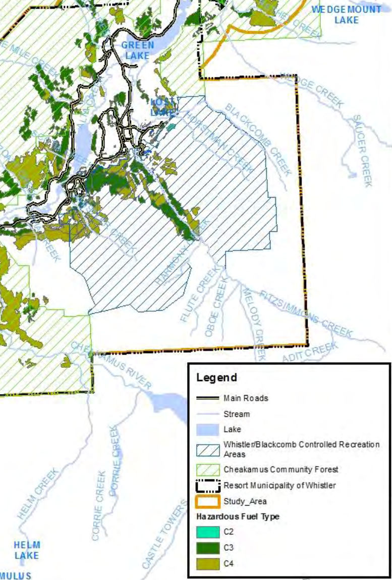
Above: Fitzsimmons Creek fuel types
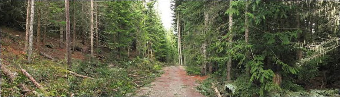
Above: Before thinning on right side of road
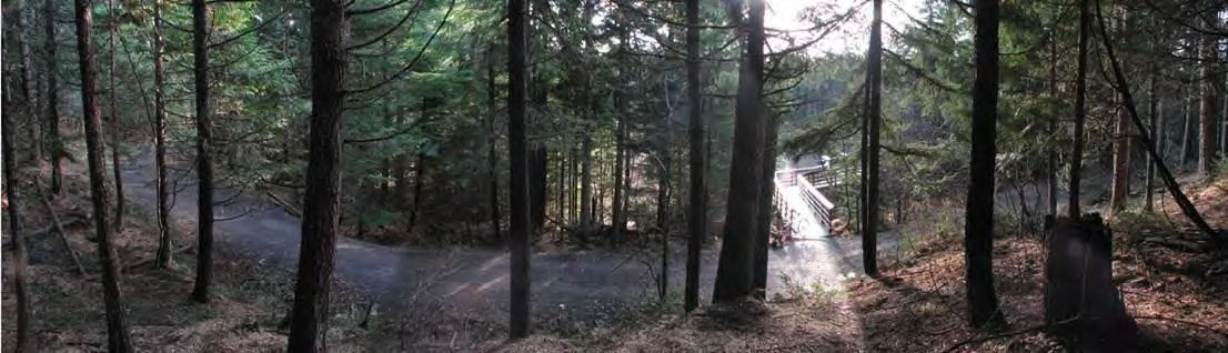
Above: After thinning
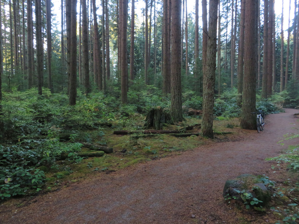
Above: Sample plot from Pacific Spirit Park. The foreground part of the photo would have about 250 to 350 stems per hectare, possibly a few more, but the background part with more and smaller diameter trees looks to have more - possibly 500-600 stems per hectare.