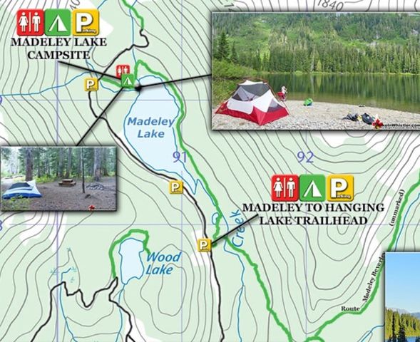
HikeInWhistler.com reports on its website: This year Whistler Sport Legacies and Whistler Photo Safaris have blocked public access to Madeley Lake. Whistler Photo Safaris now refers to Madeley Lake as "within our 2700 acre gated bear habitat." This new gate installed in the spring of 2020 was a surprise to those of us who love this amazing lake and hike the decades old, popular Madeley to Hanging Lake trail which connects to Rainbow Lake, which descends down the Rainbow Trail to Alta Lake Road in Whistler. Hopefully this gate will be gone soon as apparently everyone, including the Resort Municipality of Whistler were unaware of it until recently. Blocking public access to what was recently public land in order to allow a private company to profit off it as an expensive pay access safari park seems like a bad idea.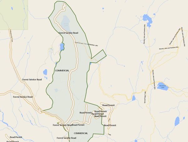
Another example how public access erodes when commercial tenures are granted.
- Written by Paul Kubik
- Hits: 2598
I received a communication from the
Federation of Mountain Clubs of BC
that Madeley Lake road is blocked by Whistler Olympic Park a few hundred metres after it leaves the Callaghan Lake Road.This means there isn’t any driving access to Madeley Lake or the Rainbow-Madeley trailhead about 5 km from the start of the FSR.
The accompanying map shows the commercial tenure of Whistler Olympic Park. The FSR down the centre of the photo is the Madeley Lake FSR. For some reason, the government map identifies the lake at the end of the FSR as Powell Lake but it seems to be known locally as Madeley Lake. The Rainbow-Madeley trailhead is about 600 meters south of Madeley Lake.